2020 Bathing Water Profile for Seaton (Cornwall)
-
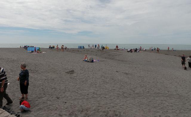
Seaton is at the mouth of the River Seaton on the south coast of Cornwall. It is a remote sandy beach, approximately 550 metres wide, surrounded by cliffs and hills. The River Seaton flows across the beach to the sea.
-
Cornwall
-
Cornwall
-
Since 2010 the Environment Agency has carried out additional catchment monitoring alongside routine bathing water monitoring. The Environment Agency are using a DNA tracing technique that helps us identify whether sources of faecal pollution are animal or human with surveys carried out in wet and dry weather conditions.This work has shown that water quality can be impacted by both human and animal sources during periods of wet weather.
-
There is an emergency/storm overflow from the Seaton pumping station that discharges into the sea approximately 260m southwest of the bathing water. The operation of the overflow can lead to a temporary drop in bathing water quality.
-
The sewage treatment scheme for Seaton and Downderry, which provides secondary treatment and ultraviolet (UV) disinfection, was completed by South West Water in early 1998. The scheme included the removal of untreated discharges which were retained as combined sewer overflows (CSO), and the construction of a sewage treatment works at Seaton. Storm overflow event duration monitoring (EDM) was installed at Seaton pumping station by December 2011, and at Church Square CSO, Scawns Hill CSO, and the Factory pumping station by April 2015. UV disinfection was installed at Menheniot sewage treatment works (STW) by April 2015, together with work to reduce the frequency of storm discharges from the Menheniot CSO.
-
For the four year (2016-2019) assessment period where data is available, seaweed (macroalgae) was assessed as being sufficient to be objectionable for 5% of visits, with 90% of visits noting the presence of seaweed (macroalgae). The bathing water can become covered with large amounts of seaweed, depending on tides and the weather. This bathing water does not have a history of large amounts of seaweed, but that it can be noticeable from time to time.
-
For the four year (2016-2019) assessment period where data is available, phytoplankton (microscopic algae) was assessed as being sufficient to be objectionable for 1% of visits, with 0% of visits noting the presence of phytoplankton (microscopic algae). Phytoplankton (microscopic algae) naturally increase in number at certain times of the year. This process is known as a phytoplankton bloom. This bathing water does not have a history of phytoplankton blooms. The risks to human health from contact, ingestion or inhalation with marine algae that currently occur in UK coastal waters are considered to be low. However, some individuals may be more sensitive and display some reactions. A common marine algae found in UK coastal waters is Phaeocystis, which is often mistaken for sewage as it forms foam and a brown scum, but it is non-toxic.
-
This bathing water is subject to short term pollution procedures. The Environment Agency makes a daily pollution risk forecast at this site based on the effects of rain, tide and wind on bathing water quality. These factors affect the levels of bacteria that get washed into the sea from livestock, sewage and urban drainage via rivers and streams and how they disperse. When these factors combine to make short term pollution likely we issue a pollution risk warning on this website and the beach manager will display a sign advising against bathing at the bathing water. After a short term pollution event, levels of bacteria typically return to normal after a day or so but it’s possible to have several warning days in a row. Details of the work to reduce the sources of bacteria at this bathing water are detailed in this profile. In 2019 16 pollution risk warnings were issued for this bathing water. All bathing waters have the potential to be affected by a pollution incident and if this occurs a pollution risk warning will be issued with associated advice against bathing on this website.
-
2020 Bathing Water Profile for Seaton (Cornwall)
-
2020-09-30
-
2020-05-01
-
Streams and rivers are typically affected by human sewage, animal slurry and runoff from roads. The River Seaton enters the sea at this beach. The Environment Agency have monitored the river since 1986 and found that water quality is temporarily worse during and after heavy rainfall.
-
The outfall from the Seaton STW discharges into the River Seaton approximately 1.7km upstream of the bathing water. This discharge is disinfected and designed to protect bathing water quality. The outfall and storm overflow from Menheniot STW discharge to the River Seaton approximately 8.5km upstream of the bathing water. The operation of this works and its impact on bathing waters was reviewed, and the treated effluent is now disinfected to protect bathing water quality.
-
Environment Agency samplers make observations of litter present on the beach at every visit, this includes assessments of sewage debris, litter and tar. At Seaton (Cornwall) for the four year (2016-2019) assessment period where data is available, sewage debris was not noted at this site.litter was assessed as being sufficient to be objectionable for 1% of visits, with 82% of visits noting the presence of litter. Tarry residue was not noted at this site.
-
During and after periods of heavy rainfall, runoff to the Seaton River from agricultural land is greatly increased, and the quality of the bathing water can be reduced. We are working with local farmers to reduce this runoff and referring them to our partners in Catchment Sensitive Farming for advice and possible grant aid for improvements. A number of grants have already been awarded in the locality and improvements completed, including fencing livestock out of streams, covering yards and stores to reduce the amount of dirty water produced, concreting yards and tracks. The Cornwall Wildlife Trust also continue to work with farmers in the catchment.
-
There are homes in the village of Hessenford that are not on the main sewerage system and have private sewage treatment arrangements. The Environment Agency has identified a number of properties which are connected to failing treatment systems, which are contributing to poor water quality in the River Seaton. We are working with private householders and South West Water to try to tackle these polluting discharges and find alternative sewage treatment arrangements.
-
The catchment surrounding Seaton is approximately 5,600 hectares. The River Seaton rises on Bodmin Moor and flows through the village of Hessenford, before entering the sea at Seaton. The total length of the main river is approximately 18 kilometres (km) (61km including the major tributaries). The steep narrow valley in the upper catchment means rain runs off rapidly into the river. Below Hessenford, the river widens and a distinct floodplain has developed up to 100m wide. The Seaton valley contains several wetland features such as spring-fed floodplain woodlands which are rare UK habitats. Land use is mainly unimproved acid grassland on the moor with improved grasslands in the upper half of the catchment. This gives way to arable as you move south towards the coast. There are some heavily wooded valleys, and urban areas including Liskeard, Seaton, Hessenford, Widegates, St Cleer and Tremar. The catchment contains two geological Sites of Special Scientific Interest (SSSI’s) - Crows Nest and Clicker Tor Quarry.
-
Seaton (Cornwall)
-
Seaton (Cornwall)
-
Sampling point at Seaton (Cornwall)
-
230370
-
50.36435089286344
-
-4.38643443196306
-
54330
-
Sampling point at Seaton (Cornwall)
-
-
-
p152 dT23 h59 m59 s
-
2020 05 01 t00:00:00
-
2020-05-01T00:00:00
-
-
2020 09 30 t23:59:59
-
2020-09-30T23:59:59
-
-
-
2020 26800:1
-
Seaweed (macroalgae) and phytoplankton (microscopic algae) are a natural part of the marine and freshwater environment. Below we note whether these have been recorded in quantities sufficient to be a nuisance.
-
The majority of sewers in England are “combined sewers” and carry both sewage and surface water from roofs and drains. A storm overflow operates during heavy rainfall when the sewerage system becomes overwhelmed by the amount of surface water. The overflow prevents sewage from backing up pipes and flooding properties and gardens. An emergency overflow will only operate infrequently, for example due to pump failure or blockage in the sewerage system.
-
Heavy rain falling on pavements and roads often flows into surface water drains or highway drains, ending up in local rivers and ultimately the sea. The quality of bathing water may be adversely affected as a result of such events.
-
It is the Environment Agency role to drive improvement of water quality at bathing waters that are at risk of failing higher standards. It is natural for water to run off the land to the sea. Water quality at a bathing water is dependent upon the type and area of land (the catchment) draining to the water and the activities undertaken in that catchment.
-
Discharges from sewage treatment works have improved substantially in England since the 1980s.
-
