2024 Bathing Water Profile for Berrow North of Unity Farm
-
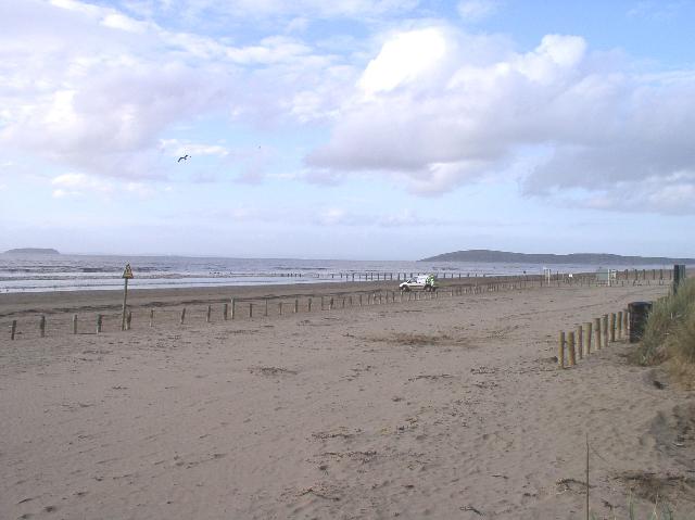
Berrow North of Unity Farm is on the Somerset coast overlooking the Bristol Channel. It is a fairly remote sandy beach, approximately 6.4 kilometres wide, backed by sand dunes.
-
Sedgemoor District
-
Somerset
-
In the past this bathing water was affected by sewage discharges from West Huntspill sewage treatment works (STW) and Bridgwater STW. The Wessex Water sewage treatment scheme for West Huntspill, which provided secondary treatment, was partially completed during 1997. Ultraviolet (UV) disinfection was added in 2000. The Wessex Water sewage treatment scheme for Bridgwater, which provides secondary treatment and UV disinfection was also completed in 2000. Two storm overflows at the pumping stations at Wembon, and Enmore Road Reservoir were improved by December 2001, and April 2002. A further eight storm overflows in Bridgwater and a storm overflow in Burnham had improvements completed by April 2005. In 2004, the storage capacity of the Highbridge storm tanks was increased to reduce discharge frequency and volume. A £36M program of sewerage improvements aimed at protecting bathing water quality in Bridgwater Bay was completed in April 2018. This included building new storage tanks to reduce storm water being released into rivers and the sea, a first time sewerage scheme at Dunball, UV disinfection at Cannington sewage works and at Highbridge storm tanks discharge and an end to the continuous discharge from Combwich STW.
-
For the four year (2020-2023) assessment period where data is available, seaweed (macroalgae) was assessed as being sufficient to be objectionable for 5% of visits, with 73% of visits noting the presence of seaweed (macroalgae). This bathing water does not have a history of large amounts of seaweed (macro algae).
-
For the four year (2020-2023) assessment period where data is available, phytoplankton (microscopic algae) was not assessed as being sufficient to be objectionable, but was observed as being present on 2% of visits. Phytoplankton (microscopic algae) naturally increase in number at certain times of the year. This process is known as a phytoplankton bloom. This bathing water does not have a history of phytoplankton blooms. The risks to human health from contact, ingestion or inhalation with marine algae that currently occur in UK coastal waters are considered to be low. However, some individuals may be more sensitive and display some reactions. A common marine algae found in UK coastal waters is Phaeocystis, which is often mistaken for sewage as it forms foam and a brown scum, but it is non-toxic.
-
There are no active pollution risk forecasts made at this bathing water. However any bathing water has the potential to be affected by a pollution incident and if this occurs a pollution risk warning with associated advice against bathing will be issued on this website.
-
2024 Bathing Water Profile for Berrow North of Unity Farm
-
2024-09-30
-
2024-05-01
-
The river Brue and river Parrett flow into Bridgwater Bay 1.5km south of the bathing water and, along with their tributaries, drain a very large catchment area. These rivers can affect the bathing water quality especially in times of high rainfall. The Environment Agency has investigated pollution sources along the river Brue since 2007 and the Parrett since 2011.
-
There are no STW discharges directly to the bathing water. The closest STW outfall is from West Huntspill works over three kilometres from the bathing water. This works discharges UV disinfected effluent and is designed to protect bathing water quality. A scheme to increase the capacity of West Huntspill STW has recently been completed which will result in a further improvement in the quality of the discharge.
-
Environment Agency samplers make observations of litter present on the beach at every visit, this includes assessments of sewage debris, litter and tar. At Berrow North of Unity Farm for the four year (2020-2023) assessment period where data is available, sewage debris was not assessed as being sufficient to be objectionable, but was observed as being present on 4% of visits. Litter was assessed as being sufficient to be objectionable for 3% of visits, with 80% of visits noting the presence of litter. Tarry residue was not assessed as being sufficient to be objectionable, but was observed as being present on 2% of visits.
-
The Berrow catchment is partly agricultural with areas of land used for livestock. During and after periods of heavy rainfall, runoff from agricultural land is greatly increased, and the quality of the bathing water can be reduced. The Environment Agency are working with Natural England and farmers on Catchment Sensitive Farming programmes to encourage better farming practices and improve water quality in the surrounding areas.
-
There some caravan parks and houses that are not on the main sewerage system and have private sewage treatment arrangements. If any concerns arise about the private sewage treatment arrangements, the Environment Agency will investigate and request immediate remedial action from those responsible.
-
The catchment surrounding Berrow North of Unity Farm is approximately 245,800 hectares and includes the rivers Parrett, Huntspill, and Brue. The Parrett, Huntspill and Brue rivers flow from the steep uplands of the Quantocks, Blackdown Hills and Mendips. The rivers flow north and west into the extensive low-lying floodplain of the Somerset Levels and Moors through various man-made drainage channels to the Severn Estuary at Bridgwater Bay. The steep catchment means rain runs off rapidly into the rivers. Rivers and other streams in the Somerset Levels are controlled by sluices which manage the volume of freshwater entering Bridgwater Bay The River Parrett is 60km long and flows through Dorset and Somerset to its mouth at Burnham-on-Sea. The main tributaries of the Parrett are the rivers Isle, Tone, Yeo and Cary. The Tone joins the tidal Parrett 30km inland at Burrowbridge. The River Cary rises at Castle Cary and flows west into the man-made King's Sedgemoor Drain at Henley Corner. It continues across the Somerset Moors and joins the tidal River Parrett downstream of Bridgwater at Dunball Sluice. The River Huntspill is a man-made river in the Sedgemoor district of the Somerset Levels that joins the River Parrett just south of Highbridge. The river was built to act as a long reservoir to provide an all year-round supply of water for the Royal Ordnance Factory near Puriton, as well as to help drain parts of the lower Brue Valley. The River Brue rises in Somerset and falls quickly in a narrow valley to a point just beyond Bruton where it is joined by the River Pitt. To the northeast of Glastonbury, the Brue is joined by various man-made drainage channels before entering the Bristol Channel. The catchment is mostly rural, with urban areas making up only five per cent of the total. The majority of the land is used for large scale agriculture, with more than 50 farms.
-
Berrow North of Unity Farm
-
Berrow North of Unity Farm
-
Sampling point at Berrow North of Unity Farm
-
329114
-
51.28173368068762
-
-3.017751052337732
-
154114
-
Sampling point at Berrow North of Unity Farm
-
-
-
p152 dT23 h59 m59 s
-
2024 05 01 t00:00:00
-
2024-05-01T00:00:00
-
-
2024 09 30 t23:59:59
-
2024-09-30T23:59:59
-
-
-
2024 35500:1
-
Seaweed (macroalgae) and phytoplankton (microscopic algae) are a natural part of the marine and freshwater environment. Below we note whether these have been recorded in quantities sufficient to be a nuisance.
-
The majority of sewers in England are “combined sewers” and carry both sewage and surface water from roofs and drains. A storm overflow operates during heavy rainfall when the sewerage system becomes overwhelmed by the amount of surface water. The overflow prevents sewage from backing up pipes and flooding properties and gardens. An emergency overflow will only operate infrequently, for example due to pump failure or blockage in the sewerage system.
-
Heavy rain falling on pavements and roads often flows into surface water drains or highway drains, ending up in local rivers and ultimately the sea. The quality of bathing water may be adversely affected as a result of such events.
-
It is the Environment Agency role to drive improvement of water quality at bathing waters that are at risk of failing higher standards. It is natural for water to run off the land to the sea. Water quality at a bathing water is dependent upon the type and area of land (the catchment) draining to the water and the activities undertaken in that catchment.
-
Discharges from sewage treatment works have improved substantially in England since the 1980s.
-
