2024 Bathing Water Profile for Windermere, Rayrigg Meadow
-
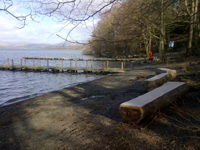
Rayrigg Meadow is located on the eastern edge of Lake Windermere. The beach at Rayrigg Meadow is shallow sloping and made up of gravel with larger rocks towards the water's edge.
-
South Lakeland District
-
Cumbria
-
Lake Windermere is located in the Lake District National Park in South Cumbria. It is divided by a shallow sill into two basins: north and south. Several rivers, draining the surrounding Lakeland fells, flow into the lake. The largest river is the Rothay, located to the north. Land in the north is largely used for sheep grazing whilst the southern area is more wooded. Tourism is vitally important to the local economy and the whole catchment is used intensively for recreational purposes throughout the year. In 2009 a study was carried out by the Environment Agency on the three bathing waters in Lake Windermere. Sources that could impact bathing water quality were confirmed as the River Rothay at the head of the lake to which Ambleside Sewage Treatment Works discharges, Mill Beck (one kilometre south of the bathing water), the Bowness Pumping Station (also known as Glebe Road storm overflow which discharges two kilometres south of the bathing water) and Trout Beck (one kilometre to the north of the bathing water). The impact of the Windermere Sewage Treatment Works at Tower Wood on bathing water quality in the lake is dependant on the wind direction and strength. In 2009 the Environment Agency repeated an earlier campaign, carried out in 2002, which looked at the sewage disposal from boats on the lake to protect bathing water quality. Byelaws on Windermere prohibit the direct discharge from boat toilets to the lake. More recently, the Love Windermere Partnership was set up in 2022 between nine organisations from a wide range of sectors, including the Environment Agency. The partnership aims to understand the pressures facing Windermere and prioritise effective solutions to improve the condition of the lake, and thereby improve bathing water quality. In 2023 the source apportionment model for phosphorus in the Windermere catchment was updated and made public, identifying the main sources of phosphorus to the catchment. During 2024 the Environment Agency has been undertaking a permit review process of a selection of water company discharge permits to ensure that the permit limits are fit for purpose. A selection of non-mains permits were also audited during 2023/2024. This included an inspection of the plant, reviewing sample results and identifying improvements to be made.
-
The Bowness Pumping Station (also known as Glebe Road storm overflow), which is just under 1.5 kilometres south of Rayrigg Meadow bathing water, was upgraded in 2013 to resolve flooding in the area. This is the only storm overflow that discharges directly to the lake. Between 2015 and 2020, Glebe Road Pump Station received upgrades to reduce the spill frequency. All storm overflows around Windermere are equipped to monitor the duration of spills and United Utilities have published an online map detailing the location of live spills events. This information can be used to aid a swimmer's decision to enter the water.
-
Windermere WwTW discharges straight to south basin and Ambleside WwTW discharges to the Rothay. In 1992 phosphorus removal technology was introduced at Windermere WwTW and Ambleside WwTW. This led to a significant reduction in the lake's phosphorus concentrations. Between the early 2000s and 2020, the water company invested £70 million to improve the water quality in Windermere. UV treatment was introduced at Windermere WwTW and Ambleside WwTW during the investment period between 2000-2005, ensuring effective disinfection of the discharge from the treatment works to protect bathing water quality. UV treatment at Windermere WwTW was then upgraded further between 2015 and 2020. Total phosphorus limits have been progressively tightened over the last 20 years from their initial introduction of 2 mg/l in the early 2000s to 0.5 mg/l at Ambleside WwTW and 0.25 mg/l at Windermere WwTW. Investment announced in 2023 plans to reduce spills from various storm overflows across the catchment by 2030.
-
The Love Windermere Partnership, which formed in 2022, brings together the Environment Agency, Lake District National Park Authority, the Lake District Foundation, The National Trust, South Cumbria Rivers Trust, National Farmers Union, Westmoreland and Furness Council, United Utilities and Cumbria Local Enterprise Partnership with the aim of using collective expertise to identify and address critical knowledge gaps regarding impacts on water quality in Windermere. The partnership work involves various workstreams, all working towards the overall goal of improving the condition of the lake. Citizen Science work in the catchment, such as the Big Windermere Survey, also helps to focus efforts made by the Environment Agency to improve water quality by identifying pollution hotspots.
-
Lake Windermere can occasionally have aquatic plants washed up on the shore which can be slippery on foot. If you have any concerns please contact the local authority health contact for help and advice.
-
Sewerage systems are either combined systems that collect both surface water runoff and foul sewage and delivers it to the treatment works; or separate systems that keep the surface water separate to the foul drainage. Misconnections occur when wastewater pipes are plumbed into surface water drains instead of the foul water sewerage system. This can give rise to pollution when the wastewater is discharged directly to the environment through the surface water drain. For example, a washing machine or toilet may be incorrectly plumbed so that it discharges to the surface drain rather than the foul sewage drain. Investigations by the Environment Agency and the water company are ongoing into suspected misconnections on Mill Beck.
-
For the four year (2020-2023) assessment period where data is available, phytoplankton (microscopic algae) was assessed as being sufficient to be objectionable for 5% of visits, with 22% of visits noting the presence of phytoplankton (microscopic algae). Algal blooms can be exacerbated under certain conditions including nutrient enrichment and the increasing temperatures and extreme weather patterns that are occurring with climate change. The presence of algae is not assessed when determining the bathing water quality. Therefore, it is possible that bathing waters can have very low levels of harmful bacteria but have the right conditions for algal blooms to occur. Not all types of algae pose a health risk to swimmers. However, there is some risk to human health if a person comes into direct contact with blue-green algae. It can also be a risk to animals such as dogs who may swim in or drink from affected water. Sightings of blue-green algae can be reported via the Environment Agency's incident line and also logged using UK CEH's ‘Bloomin Algae' app. If a bloom of blue-green algae is visible you are advised not enter the water and to contact your local authority health contact for help and advice. This bathing water also has a history of phytoplankton blooms which are not harmful, but they can result in the water appearing discoloured or a foam forming on the water. Blue-Green Algal blooms are a naturally occurring environmental phenomenon which become more likely during periods of warm, dry weather. Nutrients (principally phosphorus) contribute to the formation of blooms in the right conditions.
-
There are no active pollution risk forecasts made at this bathing water. However any bathing water has the potential to be affected by a pollution incident and if this occurs a pollution risk warning with associated advice against bathing will be issued on this website.
-
2024 Bathing Water Profile for Windermere, Rayrigg Meadow
-
2024-09-30
-
2024-05-01
-
The River Rothay flows into the top of the north basin of Lake Windermere. This source could impact upon bathing water quality. The River Brathay which drains the Langdale valley joins the River Rothay immediately before the Rothay flows into the lake. Smaller streams such as the Trout Beck, Mill Beck and Meadow Beck can impact upon bathing water quality depending on the strength of the wind direction as well as river flow. Mill Beck has been observed to have elevated bacterial and nutrient concentrations in both the Big Windermere Survey and Environment Agency's monitoring.
-
The only outfall of treated effluent directly to Lake Windermere is from Windermere WwTW at Tower Wood. All other treatment works discharge to rivers that flow into the lake.
-
Environment Agency samplers make observations of litter present on the beach at every visit, this includes assessments of sewage debris, litter and tar. At Windermere, Rayrigg Meadow for the four year (2020-2023) assessment period where data is available, sewage debris was not noted at this site. Litter was not assessed as being sufficient to be objectionable, but was observed as being present on 51% of visits. Tarry residue was not noted at this site.
-
The catchment area around Lake Windermere contains large amounts of farmland. During and after periods of heavy rainfall excess water may not soak into agricultural land causing runoff into the streams and rivers entering the lake as well as the lake itself. The quality of the bathing water may decline as a result of such events. A partnership between Natural England and the Environment Agency, as part of the England Catchment Sensitive Farming Delivery Initiative, aims to improve the Environment Agency understanding of pollution issues . Following this initiative, the Environment Agency work closely with farmers to enhance farming practices and reduce run off from farmland. The Environment Agency have developed nutrient management plans with farmers, given advice on the handling and storage of manures and helped them apply for grants to improve manure storage. In 2009 a pollution prevention campaign was completed by the Environment Agency in the Cunsey Beck and Black Beck catchments which drain to the south basin of Lake Windermere to the north of Fell Foot. The campaign was aimed at improving farm practices and gave advice on improvements that could be made. The Environment Agency regulates the farming sector through programmed risk-based inspections against a range of legal requirements and offer advice and guidance on best farming practice and preventing pollution.
-
There are a number of discharges from private sewage systems serving some of the large hotels situated beside the lake. There are also several hundred private septic tanks which discharge either directly to the lake or into its tributaries. The lake is also used by many small boats and pleasure crafts. The Environment Agency regulates these discharges and where there is a risk to bathing water quality the Environment Agency will step in to ensure improvements are made. The Love Windermere Non-Mains Drainage workstream is focussed on ensuring septic tanks and private sewage treatment works are well maintained within the catchment. The Love Windermere Partnership also has a Land Management work stream that aims to understand how the current state of Windermere relates to land management in the catchment and develop a suite of interventions for land managers that reduces run-off.
-
Lake Windermere is located in the Lake District National Park in South Cumbria. It is divided by a shallow sill into two basins: north and south. Several rivers, draining the surrounding Lakeland fells, flow into the lake. The largest river is the Rothay, located to the north. Land in the north is largely used for sheep grazing whilst the southern area is more wooded. Tourism is vitally important to the local economy and the whole catchment is used intensively for recreational purposes throughout the year.
-
Windermere, Rayrigg Meadow
-
Windermere, Rayrigg Meadow
-
Sampling point at Windermere, Rayrigg Meadow
-
340177
-
54.3781618660443
-
-2.922499452360544
-
498465
-
Sampling point at Windermere, Rayrigg Meadow
-
-
-
p152 dT23 h59 m59 s
-
2024 05 01 t00:00:00
-
2024-05-01T00:00:00
-
-
2024 09 30 t23:59:59
-
2024-09-30T23:59:59
-
-
-
2024 45675:1
-
Seaweed (macroalgae) and phytoplankton (microscopic algae) are a natural part of the marine and freshwater environment. Below we note whether these have been recorded in quantities sufficient to be a nuisance.
-
The majority of sewers in England are “combined sewers” and carry both sewage and surface water from roofs and drains. A storm overflow operates during heavy rainfall when the sewerage system becomes overwhelmed by the amount of surface water. The overflow prevents sewage from backing up pipes and flooding properties and gardens. An emergency overflow will only operate infrequently, for example due to pump failure or blockage in the sewerage system.
-
Heavy rain falling on pavements and roads often flows into surface water drains or highway drains, ending up in local rivers and ultimately the sea. The quality of bathing water may be adversely affected as a result of such events.
-
It is the Environment Agency's role to drive improvement of water quality at bathing waters. The water quality at a bathing water is dependent upon the type and area of land (the catchment) draining to the water and the activities undertaken in that catchment. The two main pressures affecting the quality of the bathing waters in Windermere are nutrient enrichment (contributing to algal blooms) and bacterial pollution. These issues are being exacerbated by the rising temperatures and extreme weather patterns that are currently occurring with climate change. A large part of managing bathing water quality involves reducing the input from pollutant sources. The main sources consist of both mains and non mains sewage effluent, agriculture and other land management activities.
-
Discharges from sewage treatment works have improved substantially in England since the 1980s.
-
