2024 Bathing Water Profile for Selsey
-
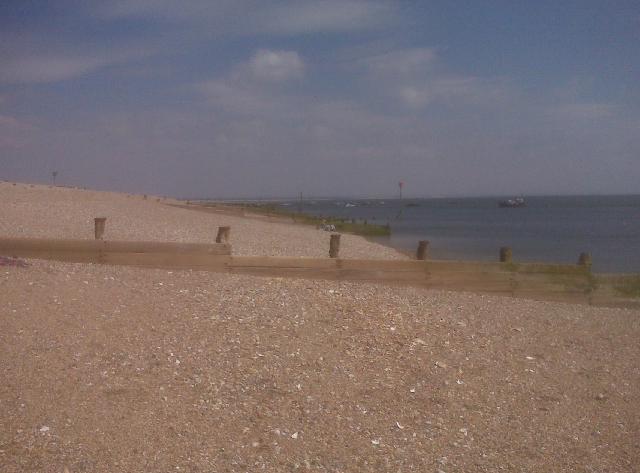
The bathing water is situated on the south coast between Pagham Harbour and Selsey Bill in West Sussex. The bathing water faces southeast and is primarily a groyned, shingle beach but with some sand exposed at low water. To the north of the bathing water there are underwater rock formations which are exposed at low water. A promenade sits above much of the beach with the town of Selsey immediately to the south.
-
Chichester District
-
West Sussex
-
There is a storm overflow 300m to the south of the bathing water called East Beach Road storm overflow. Also, the Bognor Long Sea Outfall (6 km offshore) is now a storm overflow. Discharges occur when heavy rainfall overwhelms the sewerage system but are designed not to affect bathing water compliance.
-
Prior to 2001, treated sewage was discharged from Bognor long sea outfall (6 km from the bathing water). In 2001, flows from Bognor Long Sea Outfall were diverted to a new sewage treatment works at Ford for further treatment and then discharged out of Littlehampton Long Sea Outfall (18km from the bathing water). The Bognor outfall was retained solely for storm discharges. As part of Southern Water’s Bathing Water Enhancement Programme (from 2016 to 2019), Southern Water have worked with partners and delivered solutions to improve bathing water quality.
-
For the four year (2020-2023) assessment period where data is available, seaweed (macroalgae) was not assessed as being sufficient to be objectionable, but was observed as being present on 46% of visits. This bathing water does not have a history of large amounts of seaweed.
-
Modern sewerage systems have two separate systems, one takes foul sewage to sewage treatment, the other takes rainwater runoff through surface water drains to rivers, lakes and the sea. Misconnections occur when waste water pipes are plumbed into surface water drains instead of the foul water sewerage system. This can give rise to pollution when the waste water is discharged directly to the environment through the surface water drain. For example, a washing machine or toilet may be incorrectly plumbed so that it discharges to the surface drain rather than the foul sewage drain.
-
For the four year (2020-2023) assessment period where data is available, phytoplankton (microscopic algae) was not noted at this site. The risks to human health from contact, ingestion or inhalation with marine algae that currently occur in UK coastal waters are considered to be low. However, some individuals may be more sensitive and display some reactions. A common marine algae found in UK coastal waters is Phaeocystis, which is often mistaken for sewage as it forms foam and a brown scum, but it is non-toxic.
-
There are no active pollution risk forecasts made at this bathing water. However any bathing water has the potential to be affected by a pollution incident and if this occurs a pollution risk warning with associated advice against bathing will be issued on this website.
-
2024 Bathing Water Profile for Selsey
-
2024-09-30
-
2024-05-01
-
Pagham sewage treatment works and Sidlesham sewage treatment works discharge treated effluent into Pagham Harbour via Pagham Rife and Broad Rife respectively. Both are 5 km from the bathing water and these discharges are designed to present minimal risk to water quality.
-
Environment Agency samplers make observations of litter present on the beach at every visit, this includes assessments of sewage debris, litter and tar. At Selsey for the four year (2020-2023) assessment period where data is available, sewage debris was not noted at this site. Litter was not assessed as being sufficient to be objectionable, but was observed as being present on 37% of visits. Tarry residue was not noted at this site.
-
The bathing water is situated in the south of a low lying area known as the Manhood Peninsula. The natural drainage (hydrological) catchment surrounding the bathing water is approximately 170 hectares. Two km to the north is Pagham Harbour and most drainage in the surrounding area enters the harbour via Broad Rife. The adjacent town of Selsey is immediately to the south and the surrounding area is predominantly arable or managed grassland.
-
Selsey
-
Selsey
-
Sampling point at Selsey
-
486872
-
50.736289294798816
-
-0.770298440368953
-
93686
-
Sampling point at Selsey
-
-
-
p152 dT23 h59 m59 s
-
2024 05 01 t00:00:00
-
2024-05-01T00:00:00
-
-
2024 09 30 t23:59:59
-
2024-09-30T23:59:59
-
-
-
2024 15900:1
-
Seaweed (macroalgae) and phytoplankton (microscopic algae) are a natural part of the marine and freshwater environment. Below we note whether these have been recorded in quantities sufficient to be a nuisance.
-
The majority of sewers in England are “combined sewers” and carry both sewage and surface water from roofs and drains. A storm overflow operates during heavy rainfall when the sewerage system becomes overwhelmed by the amount of surface water. The overflow prevents sewage from backing up pipes and flooding properties and gardens. An emergency overflow will only operate infrequently, for example due to pump failure or blockage in the sewerage system.
-
Heavy rain falling on pavements and roads often flows into surface water drains or highway drains, ending up in local rivers and ultimately the sea. The quality of bathing water may be adversely affected as a result of such events.
-
It is the Environment Agency role to drive improvement of water quality at bathing waters that are at risk of failing higher standards. It is natural for water to run off the land to the sea. Water quality at a bathing water is dependent upon the type and area of land (the catchment) draining to the water and the activities undertaken in that catchment.
-
Discharges from sewage treatment works have improved substantially in England since the 1980s.
-
