2024 Bathing Water Profile for Par Sands
-
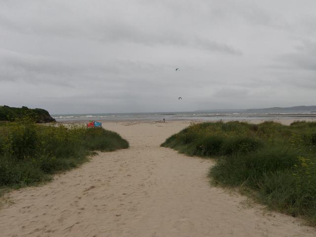
Par Sands is on the south coast of Cornwall. It is a large sandy beach resort, approximately one kilometre wide, backed by sand dunes. The Polmear Stream flows across the beach into the sea.
-
Cornwall
-
Cornwall
-
The Environment Agency have carried out extensive additional catchment monitoring alongside the Environment Agency routine bathing water monitoring. The Environment Agency used a DNA tracing technique to help identify whether sources of faecal pollution are animal or human. Surveys carried out in wet and dry weather conditions. Results showed the sources of faecal pollution to be mixed. Catchment walkovers have been carried out with to identify potential problems from agriculture. The Par River catchment is thought to affect water quality at the bathing water and all of this additional work aims to pinpoint pollution problems in the river improve water quality at the bathing water. In 2022 Par sands became a priority bathing water again, the EA added additional freshwater monitoring to build on evidence. Which in 2023 demonstrated a deterioration, but no pattern was established from the results. Previously information showed a deterioration relationship between the low tide and the mixing of the freshwater, but this pattern was not detected in.
-
There is an emergency/storm overflow from the Par No.2 pumping station that discharges to the Par River 230m upstream from the beach. There is an emergency overflow from the Par No.1 pumping station that discharges to the sea at Par Spit one and a half kilometres from the beach. The operation of the overflow can lead to a temporary drop in water quality in the Par River and at Par Sands bathing water. This bathing water is included in the Surfers Against Sewage “Safer Seas Service”. This service can alert you to Combined Storm Sewer Overflow discharges via a phone App and in addition, it includes the Environment Agency Pollution Risk Forecast warnings where they are available. Further details of the service can be found at - http://www.sas.org.uk/safer-seas-service/
-
The need for sewage treatment around the northern part of St Austell Bay was identified to protect the bathing waters at Polkerris, Par, Shorthorn, Crinnis, Charlestown, Duporth and Porthpean. The South West Water sewage treatment scheme for Polkerris, which provides fine screening, was completed in 2003. A sewage treatment works (STW) for Par at Merthen Farm (north of Crinnis) was built by South West Water in 1992 and commissioned in 1993. The scheme included the collection of sewage from Par, Charlestown, Duporth, Porthpean and part of the St Austell catchment, and transfer via a tunnel sewer to Par STW where it receives secondary treatment before being discharged through a 1.3 kilometre (km) sea outfall south of Fishing Point in St Austell Bay. The scheme also included extensive resewerage and removal of various untreated discharges and a primary treated effluent discharge at Par Spit. The storm tank at Par STW and Harbour Road (No-2) pumping station storm overflow were improved by April 2006. The sewage treatment scheme for St Austell North (Luxulyan), which provides secondary treatment and ultraviolet (UV) disinfection, was completed in early 2006. Improvements to the storm discharge from St Austell North STW were also made at that time. Storm overflow event duration monitoring (EDM) was installed at Par No.2 pumping station and St Austell North STW by April 2011. Work to reduce the frequency of storm discharges from Tredenham Close CSO and EDM installation is scheduled for completion by April 2017. SWW completed work at Luxulyan sewage treatment works in March 2021 increasing the amount of wastewater that can be treated, as well as the amount of storm water that can be stored, by constructing a new storm water tank. Increasing the capacity of our network helps reduce the need for storm overflows to operate.
-
The urban area of Par immediately behind the beach is served by a combined (surface and sewer) system.
-
For the four year (2020-2023) assessment period where data is available, seaweed (macroalgae) was assessed as being sufficient to be objectionable for 62% of visits, with 38% of visits noting the presence of seaweed (macroalgae). This bathing water does not have a history of large amounts of seaweed (macro algae).
-
Wrongly connected domestic waste water pipes can also affect the bathing water quality. We are working with Cornwall County Council and South West Water to identify and rectify any problems when they arise. Modern sewerage systems have two separate systems, one takes foul sewage to sewage treatment, the other takes rainwater runoff through surface water drains to rivers, lakes and the sea. Misconnections occur when waste water pipes are plumbed into surface water drains instead of the foul water sewerage system. This can give rise to pollution when the waste water is discharged directly to the environment through the surface water drain. For example, a washing machine or toilet may be incorrectly plumbed so that it discharges to the surface drain rather than the foul sewage drain.
-
For the four year (2020-2023) assessment period where data is available, phytoplankton (microscopic algae) was not assessed as being sufficient to be objectionable, but was observed as being present on 3% of visits. Phytoplankton (microscopic algae) naturally increase in number at certain times of the year. This process is known as a phytoplankton bloom. This bathing water does not have a history of phytoplankton blooms. The risks to human health from contact, ingestion or inhalation with marine algae that currently occur in UK coastal waters are considered to be low. However, some individuals may be more sensitive and display some reactions. A common marine algae found in UK coastal waters is Phaeocystis, which is often mistaken for sewage as it forms foam and a brown scum, but it is non-toxic.
-
This bathing water is subject to short term pollution procedures. The Environment Agency makes a daily pollution risk forecast at this site based on the effects of rain, wind and seasonality on bathing water quality. These factors affect the levels of bacteria that get washed into the sea from livestock, sewage and urban drainage via rivers and streams and how they disperse. When these factors combine to make short term pollution likely we issue a pollution risk warning on this website and the beach manager will display a sign advising against bathing at the bathing water. After a short term pollution event, levels of bacteria typically return to normal after a day or so but it’s possible to have several warning days in a row. Details of the work to reduce the sources of bacteria at this bathing water are detailed in this profile. In 2023 25 pollution risk warnings were issued for this bathing water. All bathing waters have the potential to be affected by a pollution incident and if this occurs a pollution risk warning will be issued with associated advice against bathing on this website.
-
2024 Bathing Water Profile for Par Sands
-
2024-09-30
-
2024-05-01
-
In the past there were several EA-funded farm improvements carried out in the catchment which resulted in improvements in water quality, if resourcing allows, we wish we review these and potentially seek other improvement measures. In 2024 we wish to carry out an investigation to understand in detail the sources of pollution. We will complete targeted catchment walkovers in the area to identify signs of pollution and hope to complete several of these in order to get a full picture.
-
Streams and rivers are typically affected by human sewage, animal slurry and runoff from roads. The Par River and Polmear Stream flow into the sea at this beach. The Environment Agency have monitored the Par River since 1987, and the Polmear Stream since 1992, and found that water quality is temporarily worse during and after heavy rainfall.
-
The outfall from the Par STW discharges to St Austell Bay approximately 2.9km southwest of the bathing water. This discharge has been designed to protect bathing water quality.
-
Environment Agency samplers make observations of litter present on the beach at every visit, this includes assessments of sewage debris, litter and tar. At Par Sands for the four year (2020-2023) assessment period where data is available, sewage debris was not noted at this site. Litter was assessed as being sufficient to be objectionable for 2% of visits, with 70% of visits noting the presence of litter. Tarry residue was not noted at this site.
-
There are farms in the River Par catchment, which are used for dairy and beef livestock. During and after periods of heavy rainfall, runoff to the River Par from agricultural land is greatly increased, and the quality of the bathing water can be reduced. In a 2010 ecological survey identified stretches of watercourse impacted by organic pollution, the EA then carried out targeted farm visits which confirmed issues with dirty water management on numerous farms
-
There are outfalls from the China Clay Processing Works. The water at the beach may look cloudy at times from these discharges and runoff from the harbour. The Environment Agency investigations have shown that these discharges do not affect bathing water quality at Par.
-
The catchment surrounding Par Sands is approximately 7,150 hectares. The catchment consists of the Par River and tributaries, including Tywardreath Stream, Bokiddick Brook, Carbis Stream and Treverbyn Stream. The Par River rises near the A30 then flows for approximately 14.5km before reaching the sea. The upper half of the catchment follows fairly level ground, then quickly drops after it enters the steep sided Luxulyan. Much of the remainder of the river flows within wide flood plains. In the past the Par River has been affected by the China clay industry. The combined effects of clay mining, cross catchment transfers and the porous nature of the catchment, have reduced runoff from the steep gradient of the Par River resulting in reduced peak flows to the bathing water. A second smaller stream known as the Polmear Stream enters the sea at the eastern end of the beach approximately 220 metres (m) from the Environment Agency monitoring point. The catchment is mostly agricultural, with more than 50 farms. The rural areas are dominated by improved grassland with smaller areas of arable, woodland and a significant area where china clay mining dominates the landscape. Urban areas include Par, Tywardreath, Luxulyan and Roche. The catchment is within the Cornwall Area of Outstanding Natural Beauty (AONB).
-
Par Sands
-
Par Sands
-
Sampling point at Par Sands
-
208510
-
50.34695147768081
-
-4.692854628695517
-
53140
-
Sampling point at Par Sands
-
-
-
p152 dT23 h59 m59 s
-
2024 05 01 t00:00:00
-
2024-05-01T00:00:00
-
-
2024 09 30 t23:59:59
-
2024-09-30T23:59:59
-
-
-
2024 27300:1
-
Seaweed (macroalgae) and phytoplankton (microscopic algae) are a natural part of the marine and freshwater environment. Below we note whether these have been recorded in quantities sufficient to be a nuisance.
-
The majority of sewers in England are “combined sewers” and carry both sewage and surface water from roofs and drains. A storm overflow operates during heavy rainfall when the sewerage system becomes overwhelmed by the amount of surface water. The overflow prevents sewage from backing up pipes and flooding properties and gardens. An emergency overflow will only operate infrequently, for example due to pump failure or blockage in the sewerage system.
-
Heavy rain falling on pavements and roads often flows into surface water drains or highway drains, ending up in local rivers and ultimately the sea. The quality of bathing water may be adversely affected as a result of such events.
-
It is the Environment Agency role to drive improvement of water quality at bathing waters that are at risk of failing higher standards. It is natural for water to run off the land to the sea. Water quality at a bathing water is dependent upon the type and area of land (the catchment) draining to the water and the activities undertaken in that catchment.
-
Discharges from sewage treatment works have improved substantially in England since the 1980s.
-
