2014 Bathing Water Profile for Sandy Bay Porthcawl
-
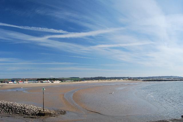
The bay faces south towards the Bristol Channel and is approximately 650 metres in length, with the harbour and promenade to the west, Coney Bay Amusement Park to the north and Rhych Point to the east. The beach is sandy and gently sloping. The water quality sample point is located at the centre beach, opposite the car park.
-
Bridgend
-
Natural Resources Wales continues to work to establish sources of pollution around Sandy Bay. Some of this work is carried out in partnership with Bridgend County Borough Council. Inspections are carried out by Natural Resources Wales in partnership with the local authority and the water company. These are carried out pre-season (before the 1st of May) and mid season if required (during the bathing water season).
-
Storm sewer discharges near Irongate Point, Hutchwns Point, Newton Point and Newton Bay can operate when heavy rainfall overwhelms the sewage system. These protect domestic properties in the catchment from being flooded by sewage and storm water during heavy rainfall. There are numerous storm outfalls that discharge into the river Ogmore and its tributaries near to Sandy Bay. Water quality in streams or rivers may decline after periods of heavy rainfall.
-
Natural Resources Wales has developed a good working relationship with Dŵr Cymru Welsh Water and liaises regularly to identify problems that could affect bathing water quality.
-
2014 Bathing Water Profile for Sandy Bay Porthcawl
-
Natural Resources Wales works with Bridgend County Borough Council to safeguard bathing water quality at Sandy Bay. Pre-season inspections are conducted in liaison with the local authority. Natural Resources Wales is a member of the Newton &Trecco Bay Management Group, facilitated by the local authority (this group does not currently have Sandy Bay within it's remit, however many relevant stakeholders attend).
-
This bathing water does not have a history of large amounts of seaweed (macroalgae).
-
Modern sewerage systems have two separate systems, one takes foul sewage to sewage treatment, the other takes rainwater runoff through surface water drains to rivers, lakes and the sea. Misconnections occur when waste water pipes are plumbed into surface water drains instead of the foul water sewerage system. This can give rise to pollution when the waste water is discharged directly to the environment through the surface water drain. For example, a washing machine or toilet may be incorrectly plumbed so that it discharges to the surface drain rather than the foul sewage drain.
-
Phytoplankton (microscopic algae) naturally increase in number at certain times of the year. This process is known as a phytoplankton bloom. These algal blooms can occur at any beach during the bathing season and are usually noticeable by a surface scum. This beach has a history of such blooms.
-
2014 Bathing Water Profile for Sandy Bay Porthcawl
-
Streams are typically affected by sewage or industrial run off from further up the catchment. During and after periods of heavy rainfall, run off from agricultural and urban areas will be greatly increased. This bathing water is also located close to the estuary of the River Ogmore. This has a large and varied catchment, which can be influenced by agricultural, urban and industrial areas. This may result in deterioration in bathing water quality at Sandy Bay following periods of heavy rainfall.
-
Pen-y -Bont Wastewater Treatment Works discharges into the estuary of the River Ogmore, approximately 5 kilometre to the East. Disinfection through ultra-violet treatment of the effluent protects the bathing water quality.
-
Natural Resources Wales continues to work with private owners regarding potential pollution sources to the bathing water. This work involves, where necessary, advisory mail drops, dye tracing, misconnection surveys and face to face meetings with Sandy and Trecco Bay Management Group. Poorly maintained private sewage treatment facilities could be a source of pollution, therefore the registration of all qualifying private sewage systems in Wales was required by 30 June 2012. The primary aim of this exercise is to provide increased protection for the environment and sensitive features such as bathing water beaches. Where discharges from properties are identified in the catchment that are not on mains sewerage, Natural Resources Wales will endeavour to ensure registration has been made, unless already a permitted discharge.
-
The natural drainage (hydrological) catchment surrounding the bathing water is highly diverse. The town of Bridgend is located in the lower catchment, with several smaller urban areas, located along the length of the tributaries of the River Ogmore. These areas are a mixture of residential and light industry. Further into the catchment, there are some forested areas and upland hill farming, predominantly sheep.
