Old Bedford and Middle Level Management Catchment
About
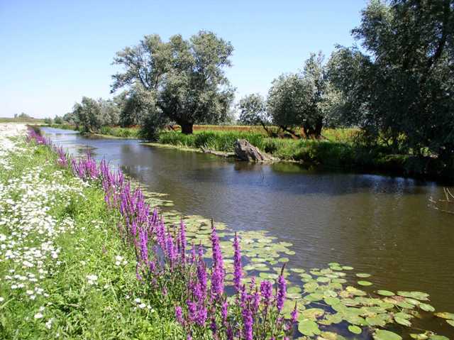
The catchment comprises an area of approximately 921 km2, with major urban areas including Whittlesey, March, Ramsey and Chatteris. It is dominated by the Middle Level System, the Counter Drain and the Hundred Foot Washes. The economy of this rural area has evolved around agriculture, the catchment being almost entirely Grade 1 agricultural land due to the historic draining of the fens. The underlying geology of the area is clay and peat. Few of the watercourses in the catchment are natural; the majority are artificially dug drains, with the movement of water being driven by pumping and drainage operations. Management of the water is undertaken by Internal Drainage Boards and the Middle Level Commissioners. Water is transferred into the Middle Level system from the River Nene at Stanground and discharged from the system at St. Germans pumping station. The Ouse Washes are a significant feature of the catchment. Created in the 17th century to provide flood storage, they run 32 kilometres from Earith to Denver. The seasonally flooded washes support important numbers of wintering wetland birds and are important for water plants and invertebrates. A keen recreational boating community exists in the navigable drains and rivers. The catchment has waters that are internationally regarded coarse fisheries and are popular angling locations. The Great Fen Project, a major project in the catchment, seeks to connect currently isolated areas of wet woodland reinstating historic washlands. The wildlife reserves across the catchment are managed by charities and are popular visitor attractions.
Classifications data for Old Bedford and Middle Level Management Catchment
Number of water bodies
The number of water bodies in the river basin district. It shows whether these are natural, artificial (such as canals and reservoirs) or have been modified ('heavily modified') for particular uses.
| Water body categories | Natural | Artificial | Heavily modified | Total |
|---|---|---|---|---|
| River, canals and surface water transfers | 0 | 5 | 1 | 6 |
| Lake | 0 | 0 | 0 | 0 |
| Coastal | 0 | 0 | 0 | 0 |
| Estuarine | 0 | 0 | 0 | 0 |
| Groundwater | 0 | 0 | 0 | 0 |
| Total | 0 | 5 | 1 | 6 |
Ecological status for surface waters
Table summarises the current ecological status of surface water bodies. Water bodies are classified as being at high, good, moderate, poor or bad ecological status or potential.
| Ecological status or potential | Bad | Poor | Moderate | Good | High | Total |
|---|---|---|---|---|---|---|
| Number of water bodies | 0 | 0 | 6 | 0 | 0 | 6 |
| Number of water body elements | 3 | 6 | 7 | 6 | 51 | 73 |
Chemical status for surface waters
Table summarises the current chemical status of water bodies. These are classified as being at good or fail.
| Chemical status | Fail | Good | Total |
|---|---|---|---|
| Number of water bodies | 6 | 0 | 6 |
| Number of water body elements | 14 | 96 | 110 |
Quantitative status for groundwater
Table summarises the quantitative status of groundwater water bodies. These are classified as being at good or poor.
| Quantitative status | Poor | Good | Total |
|---|---|---|---|
| Number of water bodies | 0 | 0 | 0 |
| Number of water body elements | 0 | 0 | 0 |
Chemical status for groundwater
Table summarises the chemical status of groundwater water bodies. These are classified as being at good or poor.
| Chemical status | Poor | Good | Total |
|---|---|---|---|
| Number of water bodies | 0 | 0 | 0 |
| Number of water body elements | 0 | 0 | 0 |
Challenges data for Old Bedford and Middle Level Management Catchment
Reasons for not achieving good status by business sector
The issues preventing waters reaching good status and the sectors identified as contributing to them. The numbers in the table are individual counts of the reasons for not achieving good status with a confidence status of 'confirmed' and 'probable', where the latest classification is less than good status. There may be more than one reason in a single water body. Note, table does not include reasons for deterioration.
| Significant water management issue | Changes to the natural flow and level of water | Invasive non-native species | Physical modifications | Pollution from abandoned mines | Pollution from rural areas | Pollution from towns, cities and transport | Pollution from waste water |
|---|---|---|---|---|---|---|---|
| Agriculture and rural land management | 2 | 0 | 4 | 0 | 3 | 0 | 0 |
| Domestic general public | 0 | 0 | 0 | 0 | 0 | 0 | 0 |
| Industry | 0 | 0 | 1 | 0 | 0 | 0 | 0 |
| Local & central government | 0 | 0 | 1 | 0 | 0 | 0 | 0 |
| Mining and quarrying | 0 | 0 | 0 | 0 | 0 | 0 | 0 |
| Navigation | 0 | 0 | 0 | 0 | 0 | 0 | 0 |
| No sector responsible | 0 | 0 | 0 | 0 | 0 | 0 | 0 |
| Other | 0 | 0 | 0 | 0 | 0 | 0 | 0 |
| Recreation | 0 | 0 | 0 | 0 | 0 | 0 | 0 |
| Sector under investigation | 0 | 0 | 12 | 0 | 0 | 0 | 0 |
| Urban and transport | 0 | 0 | 0 | 0 | 0 | 0 | 0 |
| Waste treatment and disposal | 0 | 0 | 0 | 0 | 0 | 0 | 0 |
| Water Industry | 0 | 0 | 0 | 0 | 0 | 0 | 4 |
| Total | 2 | 0 | 18 | 0 | 3 | 0 | 4 |
Objectives data for Old Bedford and Middle Level Management Catchment
Ecological status or potential objectives for surface water bodies
Table summarises the ecological status and ecological potential objectives set for water bodies in the river basin management plan. Each water body is only counted once in this table. Each water body objective consists of a target status and a date when it was, or is expected to be, met.
| Status | Bad | Poor | Moderate | Good | High | Total |
|---|---|---|---|---|---|---|
| By 2015 | 0 | 0 | 1 | 0 | 0 | 1 |
| By 2027 | 0 | 0 | 0 | 5 | 0 | 5 |
| Total | 0 | 0 | 1 | 5 | 0 | 6 |
Chemical status objectives for surface water bodies
Including those with less stringent objectives and extended deadlines
| Status | Fail | Good | Total |
|---|---|---|---|
| By 2063 | 0 | 6 | 6 |
| Total | 0 | 6 | 6 |
Quantitative status objectives for groundwater
Including those with less stringent objectives and extended deadlines
| Status | Poor | Good | Total |
|---|---|---|---|
| Total | 0 | 0 | 0 |
Chemical status objectives for groundwater
Including those with less stringent objectives and extended deadlines
| Status | Poor | Good | Total |
|---|---|---|---|
| Total | 0 | 0 | 0 |