Element of Engineered High Ground
High Ground
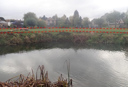
The top of high ground.
Attributes
An attribute is a particular piece of data that describes a property of an object. Each Element Type is described by a different set of attributes, although there are some attributes that are common to many Element Types.
The table below lists the attributes that are applicable to this Element Type, along with the data profile requirements for each attribute and details of when and how each should be used and delivered.
| Attribute | Format Details | Delivery | Purpose | Mandatory | geoCOBie Mapping | Updates |
|---|---|---|---|---|---|---|
| Business Function The Business Function that is responsible for the element | Picklist Air Quality Analysis & Reporting Corporate Assets Environment Management FCRM Fisheries, Biodiversity and Geomorphology (FBG) Ground Water & Contaminated Land Hydrometry and Telemetry Navigation Water Quality Water Resources | EA6 | P09 Operations | Yes | Component.Attribute.Name.BusinessFunction | 27-04-2021 View history Request changes |
| Coating Material The coating material of the element | Picklist Alkali-Activated Cementitious Material (AACM) based concrete Asphalt Bituminised Aggregate Cobbles Concrete (Granulated) Concrete In Situ Concrete Precast Armourflex Concrete (Precast) Foundry Slag Rock Armour Shingle Stone (Granulated) Stone (Unworked) Stone (Worked) Turf Other Additional Material (Describe) None | EA3 | P09 Operations | No | Component.Attribute.Name.CoatingMaterial | 27-04-2021 Picklist edited 05-09-2022 View history Request changes |
| Coating Material Description A description of the element's coating material. Only applicable where Coating Material = Other Additional Material, Plastic - Other, or Timber - Other | Text Max Length: 250 | EA3 | P09 Operations | No | Component.Attribute.Name.CoatingMaterialDescription | 27-04-2021 View history Request changes |
| Comments Other comments about the element | Text Max Length: 2000 | EA2 | P09 Operations | No | Component.Attribute.Name.Comments | 07-11-2023 View history Request changes |
| Condition The condition grade of the element | Picklist 0 - Unchecked 1 - Very Good 2 - Good 3 - Fair 4 - Poor 5 - Very Poor | EA6 | P09 Operations | No | Component.Attribute.Name.Condition | 27-04-2021 View history Request changes |
| Edge LineString 1 A spatial lineString locating the exposed edge or spatial feature of an element further classified by the associated LineStringType attribute. Edge lineStrings may be singular (Edge LineString1) required in all cases, or paired (Edge LineString 1 and 2); the second may not be required indicated by 'n/a'. A lineString is a series of design or measured spatial triple points (easting, northing, elevation) each connected by a single non-crossing line, with single points at each end, that locate an element. A lineString is expressed as a JSON array of type geoJSON lineString, e.g. [[x1,y1,z1],[x2,y2,z2],...] It is further classified by the associated LineStringType attribute confirming its relative location to the element. Interim points should be spaced at a maximum of 2m for lines < 10m in length, or 10m otherwise. The default CRS is a 3D CRS to EPSG 7405 with confirmed type, European reference frame and UK OS transformation with geoCOBie Unit of 'LineString:EPSG7405:ETRS89:OSTN15:OSGM15' | Geometry Units: LineString:EPSG7405:ETRS89:OSTN15:OSGM15 | EA2 | P09 Operations | No | Component.Attribute.Name.EdgeLineString1 | 05-09-2022 View history Request changes |
| Edge LineString 2 A spatial lineString locating the landward edge or spatial feature of an element further classified by the associated LineStringType attribute. Edge lineStrings may be singular (Edge LineString1) required in all cases, or paired (Edge LineString 1 and 2); the second may not be required indicated by 'n/a'. A lineString is a series of design or measured spatial triple points (easting, northing, elevation) each connected by a single non-crossing line, with single points at each end, that locate an element. A lineString is expressed as a JSON array of type geoJSON lineString, e.g. [[x1,y1,z1],[x2,y2,z2],...] It is further classified by the associated LineStringType attribute confirming its relative location to the element. Interim points should be spaced at a maximum of 2m for lines < 10m in length, or 10m otherwise. The default CRS is a 3D CRS to EPSG 7405 with confirmed type, European reference frame and UK OS transformation with geoCOBie Unit of 'LineString:EPSG7405:ETRS89:OSTN15:OSGM15' | Geometry Units: LineString:EPSG7405:ETRS89:OSTN15:OSGM15 | EA2 | P09 Operations | No | Component.Attribute.Name.EdgeLineString2 | 05-09-2022 View history Request changes |
| Element Crest Level The crest level of the element | Number Max: 1,000.00 Min: 0.00 Number of decimal places: 2 Units: mAOD | EA3 | P09 Operations | No | Component.Attribute.Name.ElementCrestLevel | 07-11-2023 View history Request changes |
| Element Description Description of element if required | Text Max Length: 400 | EA2 | P09 Operations | No | Component.Attribute.Name.ElementDescription | 27-04-2021 View history Request changes |
| Element ID The Element ID from the AIMS OM system, if known. | Text Max Length: 200 | EA6 | P01 Registration | Yes | Component.Attribute.Name.ElementID | 27-04-2021 View history Request changes |
| Element Location Location of element, control measure or tree(s) | Text Max Length: 200 | EA2 | P09 Operations | No | Component.Attribute.Name.ElementLocation | 27-04-2021 View history Request changes |
| Element Name The name of the element if it has one | Text Max Length: 550 | EA2 | P09 Operations | No | Component.Attribute.Name.ElementName | 07-11-2023 View history Request changes |
| Element Ref Unique element reference code in scheme context assigned by scheme designer, e.g. HGD0123 | Text Element code HGD + sequence number | EA2 | P01 Registration | No | Component.Attribute.Name.ElementRef | 27-04-2021 View history Request changes |
| Element Sequence The place in the sequential order of the elements | Number Max: 100 Min: 0 Number of decimal places: 0 | EA3 | P09 Operations | No | Component.Attribute.Name.ElementSequence | 27-04-2021 View history Request changes |
| Element Slope The slope of the element in degrees | Number Max: 90 Min: 0 Number of decimal places: 0 Units: degrees | EA3 | P09 Operations | No | Component.Attribute.Name.ElementSlope | 27-04-2021 View history Request changes |
| Element Slope Date The date that the slope of the element was captured | Date | EA6 | P09 Operations | No | Component.Attribute.Name.ElementSlopeDate | 27-04-2021 View history Request changes |
| Element Slope DQF The data quality flag defining the quality and method of capturing the slope of the element | Picklist 1 - +/- 0.01m to 0.05m vertical accuracy (Typically on site survey) 2 - +/- >0.05m to 0.15m vertical accuracy (Typically LIDAR or Photogrammetry) 3 - +/- >0.15m to 0.75m vertical accuracy (Typically older (pre 2004) LIDAR or Photogrammetry) 4 - +/- 0.75m or more vertical accuracy | EA6 | P09 Operations | No | Component.Attribute.Name.ElementSlopeDQF | 27-04-2021 View history Request changes |
| Element Type The type of element | Picklist High Ground | EA2 | P01 Registration | No | Component.Attribute.Name.ElementType | 27-04-2021 View history Request changes |
| Element Weighting The weighting of the individual element. The value will be the 'default' weighting predefined for the element type, or if Use Variant Weighting = True, then the value will be the 'variant' weighting predefined for the element type. | Picklist 1 2 3 4 5 6 7 8 9 | Auto | P09 Operations | No | Component.Attribute.Name.ElementWeighting | 18-12-2023 View history Request changes |
| Element Width The width of the element | Number Max: 1,000.00 Min: 0.00 Number of decimal places: 2 Units: metres | EA3 | P09 Operations | No | Component.Attribute.Name.ElementWidth | 27-04-2021 View history Request changes |
| Element Width Date The date that the width of the element was captured | Date | EA6 | P09 Operations | No | Component.Attribute.Name.ElementWidthDate | 27-04-2021 View history Request changes |
| Element Width DQF The data quality flag defining the quality and method of capturing the width of the element | Picklist 1 - +/- 0.01m to 0.05m vertical accuracy (Typically on site survey) 2 - +/- >0.05m to 0.15m vertical accuracy (Typically LIDAR or Photogrammetry) 3 - +/- >0.15m to 0.75m vertical accuracy (Typically older (pre 2004) LIDAR or Photogrammetry) 4 - +/- 0.75m or more vertical accuracy | EA6 | P09 Operations | No | Component.Attribute.Name.ElementWidthDQF | 27-04-2021 View history Request changes |
| LineString 1 Type The type of Edge LineString 1 | Picklist Axial Crest Invert | EA2 | P09 Operations | No | Component.Attribute.Name.LineString1Type | 27-04-2021 View history Request changes |
| LineString 2 Type The type of Edge LineString 2 | Picklist Axial Crest Invert | EA2 | P09 Operations | No | Component.Attribute.Name.LineString2Type | 27-04-2021 View history Request changes |
| Material The material of the element | Picklist Asbestos Cement Bagwork Concrete - 3D Printed Concrete Concrete - Alkali Activated Cementitious Material (AACM) - Not known if reinforced - Unknown casting method Concrete - Reinforced Autoclaved Aerated Concrete (RAAC) - Reinforced with steel - Precast Concrete - Self-healing - Reinforced with Fibre-Reinforced Polymer - Cast-in-situ Concrete - Self-healing - Reinforced with Fibre-Reinforced Polymer - Precast Concrete - Self-healing - Reinforced with Steel - Cast-in-situ Concrete - Self-healing - Reinforced with Steel - Precast Concrete - Traditional - Reinforced with Steel - Precast Concrete - Unknown subtype - Not known if reinforced - Unknown casting method Concrete - Unknown subtype - Reinforced with Fibre-Reinforced Polymer - Cast-in-situ Concrete - Unknown subtype - Reinforced with Fibre-Reinforced Polymer - Precast Concrete - Unknown subtype - Reinforced with Steel - Cast-in-situ Concrete - Unknown subtype - Reinforced with Steel - Precast Concrete - Unknown subtype - Reinforced with unknown - Cast-in-situ Concrete - Unknown subtype - Reinforced with unknown - Precast Concrete - Unknown subtype - Unreinforced - Cast-in-situ Concrete - Unknown subtype - Unreinforced - Precast Concrete - Other (describe) Earth Geogrids Geotextiles Granular Material - Boulders Granular Material - Clay Granular Material - Cobbles Granular Material - Gravel Granular Material - Sand Granular Material - Silt Granular Material - Mixed Grade Masonry - Blockwork Masonry - Brickwork Masonry - Stonework Masonry - Other (describe) Other Material (describe) Rock Turf | EA3 | P09 Operations | Yes | Component.Attribute.Name.Material | 27-04-2021 Picklist edited 18-04-2024 View history Request changes |
| Material Description A description of the element's material. Only applicable where Material = Concrete - Other, Ferrous Metal - Other, Masonry - Other, Non-ferrous Metal - Other, Other Material, Plastic - Other, or Timber - Other | Text Max Length: 100 | EA3 | P09 Operations | No | Component.Attribute.Name.MaterialDescription | 27-04-2021 View history Request changes |
| Parent Asset Ref The Asset Reference of the parent asset that this element is part of, e.g. DR0123 | Text Asset code DR + sequence number | EA2 | P09 Operations | No | Component.Attribute.Name.ParentAssetRef | 27-04-2021 View history Request changes |
| Photo A photograph or image related to the element. | Photo | EA4 | P09 Operations | No | Component.Attribute.Name.Photo | 07-11-2023 View history Request changes |
| Use Variant Weighting Has the weighting value been amended using the variant from the asset element record? | Boolean | EA6 | P09 Operations | Yes | Component.Attribute.Name.UseVariantWeighting | 27-04-2021 View history Request changes |