North Cornwall Seaton Looe and Fowey Management Catchment
Operational catchments
There are 5 operational catchments in this management catchment.
Filter map layers
Data
Protected Areas
Catchment Partnerships Pages
To view the catchment partnership pages switch to the river basin management plan
About
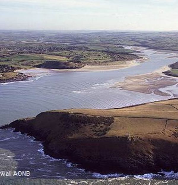
The North Cornwall, Seaton, Looe and Fowey management catchment is situated entirely within Cornwall. It includes stretches of the north and south coast as well as much of central and eastern inland Cornwall. The catchment includes rivers draining to both the north and south coast. The most notable are the Camel, which flows within the northern part of the catchment before forming the Camel estuary downstream of Wadebridge, and the Fowey, which flows in a southerly direction from Bodmin Moor before finally reaching the sea at the coastal town of Fowey. Smaller rivers draining to the north coast include the Gannel in the west and Strat / Neet in the north east, while the south coast features the rivers Looe and Seaton.The landscape within the management catchment is hugely varied, from sandy coastal beaches and the Camel estuary on the coast to the rugged uplands of Bodmin Moor. Rolling farmland and wooded river valleys also feature across the catchment. The area is predominantly rural with agriculture the dominant land use. The main inland town is Bodmin, while on the coast settlements within the catchment include Newquay, Padstow, Bude, Looe and Fowey. Tourism is valuable to the area, with coastal towns in particular seeing an influx of visitors at key times each year. There are a number of designated areas within the management catchment. Inland the River Camel and Crowdy Marsh are both Special Areas of Conservation (SAC), while the Cornwall Area of Outstanding Natural Beauty (AONB) covers parts of both coastline and Bodmin Moor. Sites of Special Scientific Interest cover a notable area within the management catchment, with a large swathe of Bodmin Moor and River Camel valley both designated. Bathing water areas are present on both coastlines.