Linked Data API
Show Search Form
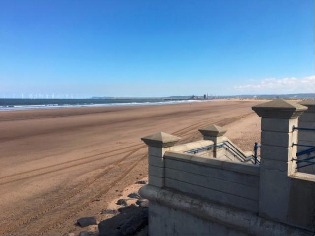
2014 Bathing Water Profile for Seaton Carew North
http://environment.data.gov.uk/data/bathing-water-profile/ukc1101-06000/2014:1
| bathing water description | Seaton Carew is a small resort on Tees Bay to the south of Hartlepool. Seaton Carew North is the northern end of an extensive sandy beach fronting the town. |  |
|||||||||||||||||||||||
|---|---|---|---|---|---|---|---|---|---|---|---|---|---|---|---|---|---|---|---|---|---|---|---|---|---|
| county name | Hartlepool | |
|||||||||||||||||||||||
| eso outfalls statement | Bathing water quality may sometimes be affected by discharges from storm outfalls. Storm overflows may operate during and after rainfall when the sewerage system can be overwhelmed by the amount of surface water entering it. These overflows prevent sewage from backing up pipes and flooding properties. Overflows discharging into streams and along the shore can also contribute. The outfall from an overflow at Mainsforth Terrace, which also carries the Burn Valley stream, has recently been repaired. Other overflows discharge to the Stell but have done so for 20 years during which bathing water quality has improved. Whether these have changed recently is included in the current investigations. Investigations into the performance of the sewerage system are due to be completed by 2016 and any improvements identified as necessary will be implemented with a target for completion before the 2018 bathing season. | |
|||||||||||||||||||||||
| history statement | Sewage from Seaton Carew and Hartlepool was discharged to sea via a number of short sea outfalls until 1993. A long sea outfall was constructed then and these flows were diverted over three kilometres offshore to improve and protect bathing water quality at the Seaton Carew beaches. In 2000, a treatment works was built at Seaton Carew and the sewage flowing to the long sea outfall has since received full treatment and disinfection using ultraviolet light. In 2007, the discharge from Billingham Sewage Treatment Works was diverted from its previous location to this long outfall to ensure that it had no adverse effect on the ecologically important area at Seal Sands. However, in recent years, bathing water quality has declined, leading to renewed investigations by both Environment Agency and Northumbrian Water. | |
|||||||||||||||||||||||
| investigations statement | We are working with Northumbrian Water to identify the source(s) of pollution that have led to the recent deterioration in bathing water quality. | |
|||||||||||||||||||||||
| macro algae statement | Environment Agency research suggests this bathing water does not have a history of large amounts of seaweed (macroalgae). | |
|||||||||||||||||||||||
| misconnections statement | Modern sewerage systems have two separate systems, one takes foul sewage to sewage treatment, the other takes rainwater runoff through surface water drains to rivers, lakes and the sea. Misconnections occur when waste water pipes are plumbed into surface water drains instead of the foul water sewerage system. This can give rise to pollution when the waste water is discharged directly to the environment through the surface water drain. For example, a washing machine or toilet may be incorrectly plumbed so that it discharges to the surface drain rather than the foul sewage drain. | |
|||||||||||||||||||||||
| phytoplankton statement | Environment Agency research suggests this bathing water does not have a history of phytoplankton blooms. | |
|||||||||||||||||||||||
| streams rivers statement | The Stell crosses the bathing water. There are a number of consented discharges to this watercourse which may impair water quality during and immediately after heavy rain. The current investigations include determining whether anything has altered which would increase their impact on bathing water quality to explain the observed deterioration. | |
|||||||||||||||||||||||
| stw outfalls statement | The location of the outfall and the high level of treatment means that those close to Seaton Carew have negligible effect on bathing water quality | |
|||||||||||||||||||||||
| version string | 1 | |
|||||||||||||||||||||||
| zoi description | The beach is close to the mouth of the River Tees, which has a catchment of approximately 2000 square kilometres. It rises in Pennine moorland, draining a largely agricultural catchment before reaching the sea via an urban/industrial estuary. Within this, smaller streams drain an area of approximately 18 square kilometres, mainly the southern half of Hartlepool and reach the sea close to this designated beach and are probably more relevant. | |
|||||||||||||||||||||||
| bathing water |
|
||||||||||||||||||||||||
| local authority | Hartlepool (B) | |
|||||||||||||||||||||||
| source | line=0026 | ||||||||||||||||||||||||
| standard language collection |
|
||||||||||||||||||||||||
| web res image | ukc1101-06000_1-webres.jpg | ||||||||||||||||||||||||