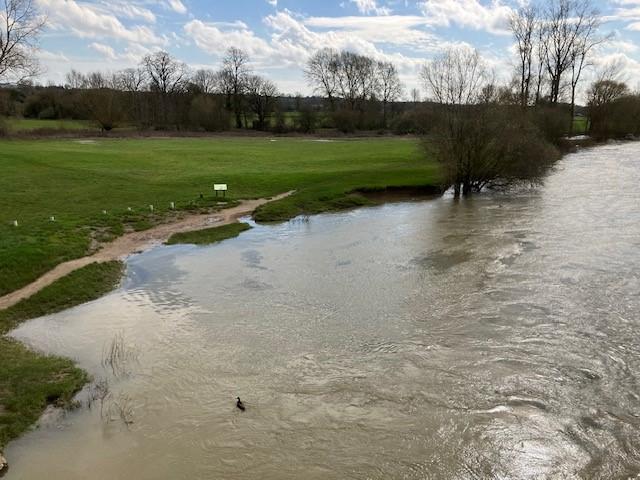
Wallingford Beach is situated on the Eastern bank of the River Thames opposite to
the town of Wallingford in the small village of Crowmarsh Gifford. The designated
bathing area is immediately south of the Wallingford Bridge. Access to the swimming
area is via sloping bank, which is adjacent to an area of grassland, and is close
to Riverside Car Park on the northern side of the bridge. The site can be accessed
from the Thames Path at Wallingford by crossing the bridge.
There are a number of storm overflows that discharge into the River Thames upstream
of Wallingford Beach. The closest is Benson Sewage Treatment works, which is around
1km upstream. Beyond that there are several other CSOs on the River Thames, and tributaries
such as the River Thame and River Ock and River Cherwell. The impact of these on the
bathing water is currently unknown, however, when any of these outfalls are operating,
they discharge diluted effluent into the river and may result in reduced bathing water
quality.
The Environment Agency works closely with Thames Water to identify and deliver significant
investment in sewerage infrastructure. The Environment Agency is supporting Thames
Water to progress catchment investigations and undertaking work to minimise surface
water entering the combined sewer, in order to reduce the operation of storm overflows.
Thames Water and the Environment Agency will work together to investigate, and plan
investment for required improvement to water quality at the bathing water.
The Environment Agency regularly carry out investigations to identify sources of pollution
in the catchment. The Environment Agency do this by monitoring the quality of rivers
and streams and visiting sites where the Environment Agency give advice on compliance
with regulations and good practice as appropriate. The Environment Agency have a duty
to undertake water quality monitoring for the bathing water.
Modern sewerage systems have two separate systems, one takes foul sewage to sewage
treatment, the other takes rainwater runoff through surface water drains to rivers,
lakes and the sea. Misconnections occur when waste water pipes are plumbed into surface
water drains instead of the foul water sewerage system. This can give rise to pollution
when the waste water is discharged directly to the environment through the surface
water drain. For example, a washing machine or toilet may be incorrectly plumbed so
that it discharges to the surface drain rather than the foul sewage drain.
Phytoplankton (microscopic algae) increase in number at certain times of the year.
This process is known as a phytoplankton bloom. Blooms of phytoplankton can result
in the water appearing discoloured or a foam forming on the water. If a bloom of blue-green
algae is visible you are advised not to enter the water and to contact the bathing
water operator.
There are no active pollution risk forecasts made at this bathing water. However any
bathing water has the potential to be affected by a pollution incident and if this
occurs a pollution risk warning with associated advice against bathing will be issued
on this website.
There is a large catchment area above Wallingford Beach, which includes rivers and
streams that will receive runoff from both urban and rural areas. The impact of these
is currently unknown, and further investigations will be required. The Environment
Agency works to improve water quality in rivers, and reduce potential sources of pollution.
Diffuse runoff from agriculture and settlements upstream of the bathing water will
also affect the bacteriological quality of Wallingford Beach
The closest sewage company discharge to Wallingford Beach is Benson Sewage Treatment
Works, which is around 1km upstream. This has a final effluent and storm/emergency
outfall. There are several other water company discharges upstream of Wallingford
Beach, both on the River Thames, and major tributaries such as the River Thame and
River Ock and River Cherwell. Further investigation is required to understand the
impact of these discharges on the bathing water.
Environment Agency samplers make observations of litter present on the beach at every
visit, this includes assessments of sewage debris, litter and tar.
Part of the Environment Agency's role is to work with farmers to reduce the effects
of farming on water quality. The Environment Agency provide advice to farmers on how
to comply with regulations and good practice on farms to ensure that pollution entering
watercourses is minimised. The River Thames catchment upstream of Wallingford Beach
is largely agricultural in places, with a combination of arable of livestock farming.
During and after periods of heavy rainfall, runoff from agricultural areas will be
greatly increased and this may adversely affect the quality of the bathing water.
There are a number of private sewage treatment plants within the catchment and the
Environment Agency continues to work with the owners to ensure that these are adequately
maintained and do not impact on the water quality of the streams they discharge to.
The River Thames at Wallingford Beach is a lowland river, with the flow being influenced
by several tributaries joining the river upstream. Flows can range from relatively
high during the winter to very low in the summer. The River Thames, up to and including
Oxford predominantly flows across Oxford Clay. Below Oxford and through Abingdon the
river flows across mudstone before reaching Benson where it then flows across Upper
Greensand and then onto Lower Chalk, just south of Wallingford. This section of the
Thames has passed through some major settlements, such as Oxford and Abingdon which
can influence the habitat and water quality. Notable tributaries downstream of Oxford
are the Cherwell, Ock, and Thame. Each of these tributaries are influenced by major
settlements such as Bicester, Banbury, and Aylesbury, alongside numerous smaller settlements.
The river ecology is also notably impacted by agricultural pressures.
The River Thames is a managed, navigable waterway, with the habitat being dominated
by navigational requirements with locks and weirs impounding reaches. As a result
fish populations can vary depending on the quality and variety of habitat. Owing to
its navigable nature, the section of the river around Wallingford Beach is a popular
area for recreational boating, and the river can be very busy with leisure craft during
the summer months.
Seaweed (macroalgae) and phytoplankton (microscopic algae) are a natural part of the
marine and freshwater environment. Below we note whether these have been recorded
in quantities sufficient to be a nuisance.
The majority of sewers in England are “combined sewers” and carry both sewage and
surface water from roofs and drains. A storm overflow operates during heavy rainfall
when the sewerage system becomes overwhelmed by the amount of surface water. The overflow
prevents sewage from backing up pipes and flooding properties and gardens. An emergency
overflow will only operate infrequently, for example due to pump failure or blockage
in the sewerage system.
Heavy rain falling on pavements and roads often flows into surface water drains or
highway drains, ending up in local rivers and ultimately the sea. The quality of bathing
water may be adversely affected as a result of such events.
It is the Environment Agency role to drive improvement of water quality at bathing
waters that are at risk of failing higher standards. It is natural for water to run
off the land to the sea. Water quality at a bathing water is dependent upon the type
and area of land (the catchment) draining to the water and the activities undertaken
in that catchment.


