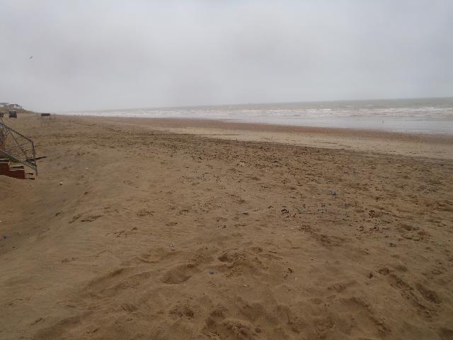
Camber Sands is situated at the mouth of the river Rother in Rye Bay, East Sussex.
The bathing water is a wide expanse of fine sand with a shallow profile and a long
tidal range. It is part of a large embayment and is truncated to the west by the training
wall of the River Rother. The bathing water is backed by sand dunes and a golf course
to the west and a large caravan park to the east. The area close to the mouth of the
Rother has strong currents.
Within the catchment of Camber Sands bathing water, there are numerous storm, emergency
and surface water outfalls. Discharges into the river Rother occur when heavy rainfall
overwhelms the sewerage system and causes diluted sewage to overflow. As such, the
bathing water can be subject to reduced water quality after periods of heavy rainfall.
Camber Sewage Treatment Works discharges via an outfall pipe across the beach at the
eastern extent of the beach. The sewage treatment works was upgraded to further treatment
and UV disinfection was installed in 1996. This discharge is designed to protect bathing
water compliance. In late 1999, a rising main sewer going through Camber village to
the sewage treatment works was relined, which has contributed to improved bathing
water quality. Under the programme of works for Southern Water (from 2020 to 2022)
investigations within the catchment were carried out. This will help to identify
where bathing water improvements may be needed in the future.
The Environment Agency carried out a number of investigations in 1999 and 2000. The
surveys were aimed at quantifying the relative contributions of potential sources
of contamination to the bathing water. No obvious single source has been identified.
Surveys have shown that water from the Rother Estuary can contain faecal contamination.
Rye sewage treatment works discharges into the Rother. Effluent from Camber sewage
treatment works has occasionally shown higher numbers of bacteria than expected under
the UV disinfection treatment in place.
For the four year (2020-2023) assessment period where data is available, seaweed (macroalgae)
was not assessed as being sufficient to be objectionable, but was observed as being
present on 54% of visits. The shore can become covered with seaweed, depending on
tides and the weather. Groynes, rocks and other fixed objects may have a covering
of seaweed which can be slippery.
Modern sewerage systems have two separate systems, one takes foul sewage to sewage
treatment, the other takes rainwater runoff through surface water drains to rivers,
lakes and the sea. Misconnections occur when waste water pipes are plumbed into surface
water drains instead of the foul water sewerage system. This can give rise to pollution
when the waste water is discharged directly to the environment through the surface
water drain. For example, a washing machine or toilet may be incorrectly plumbed so
that it discharges to the surface drain rather than the foul sewage drain.
For the four year (2020-2023) assessment period where data is available, phytoplankton
(microscopic algae) was assessed as being sufficient to be objectionable for 2% of
visits, with 10% of visits noting the presence of phytoplankton (microscopic algae).
Microscopic algae (phytoplankton) increase in number at certain times of the year.
This process is known as a phytoplankton bloom. Blooms of phytoplankton can result
in the water appearing discoloured or a foam forming on the water.
The risks to human health from contact, ingestion or inhalation with marine algae
that currently occur in UK coastal waters are considered to be low. However, some
individuals may be more sensitive and display some reactions.
A common marine algae found in UK coastal waters is Phaeocystis, which is often mistaken
for sewage as it forms foam and a brown scum, but it is non-toxic.
There are no active pollution risk forecasts made at this bathing water. However any
bathing water has the potential to be affected by a pollution incident and if this
occurs a pollution risk warning with associated advice against bathing will be issued
on this website.
The largely agricultural catchment of the Rivers Rother and Brede have significant
areas of pasture land with livestock. Within the catchments of Rother and Brede there
are also numerous private inputs and inputs from sewage treatment works. The Rother
has numerous highway drains entering the river. During and after periods of heavy
rainfall the risk of contamination from diffuse urban and agricultural pollution is
increased.
Camber sewage treatment works discharges into a small basin which then discharges
via an outfall pipe across the beach at the eastern extent of the bathing water. This
discharge is designed to protect bathing water compliance. Rye sewage treatment works
discharges into the river Rother a few kilometres upstream of the river mouth. This
discharge is treated and is designed to protect bathing water compliance.
Environment Agency samplers make observations of litter present on the beach at every
visit, this includes assessments of sewage debris, litter and tar. At Camber for the
four year (2020-2023) assessment period where data is available, sewage debris was
not noted at this site. Litter was assessed as being sufficient to be objectionable
for 5% of visits, with 87% of visits noting the presence of litter. Tarry residue
was not noted at this site.
In 2005, Defra launched the England Catchment Sensitive Farming Delivery Initiative
in partnership with the Environment Agency and Natural England. The initiative aimed
to reduce the negative effect of farming operations on the quality of surface and
ground water by raising farmer awareness and promoting catchment sensitive farming.
It put Catchment Sensitive Farming Officers into priority catchments and resourced
them to help farmers improve farming practices and reduce water pollution from agriculture.
Most of the catchment of the Rother was included as a catchment under the Catchment
Sensitive Farming Delivery Initiative.
The natural drainage (hydrological) catchment surrounding the bathing water is extensive
due to its proximity to the mouth of the River Rother. The Rother has a catchment
of approximately 75500 hectares and drains from the High Weald. It is formed of low-lying,
largely reclaimed land characterised by a network of drainage ditches. The steeply
sloping upper areas cause water to run off the land into rivers and therefore to the
beach very quickly. This catchment includes the river Brede that enters the Rother
Estuary downstream of Rye. The catchment is rural with a number of villages and small
towns set among arable and pastureland. The Rother Estuary close to the beach is artificially
retained and drains almost completely at low tide.
Seaweed (macroalgae) and phytoplankton (microscopic algae) are a natural part of the
marine and freshwater environment. Below we note whether these have been recorded
in quantities sufficient to be a nuisance.
The majority of sewers in England are “combined sewers” and carry both sewage and
surface water from roofs and drains. A storm overflow operates during heavy rainfall
when the sewerage system becomes overwhelmed by the amount of surface water. The overflow
prevents sewage from backing up pipes and flooding properties and gardens. An emergency
overflow will only operate infrequently, for example due to pump failure or blockage
in the sewerage system.
Heavy rain falling on pavements and roads often flows into surface water drains or
highway drains, ending up in local rivers and ultimately the sea. The quality of bathing
water may be adversely affected as a result of such events.
It is the Environment Agency role to drive improvement of water quality at bathing
waters that are at risk of failing higher standards. It is natural for water to run
off the land to the sea. Water quality at a bathing water is dependent upon the type
and area of land (the catchment) draining to the water and the activities undertaken
in that catchment.


