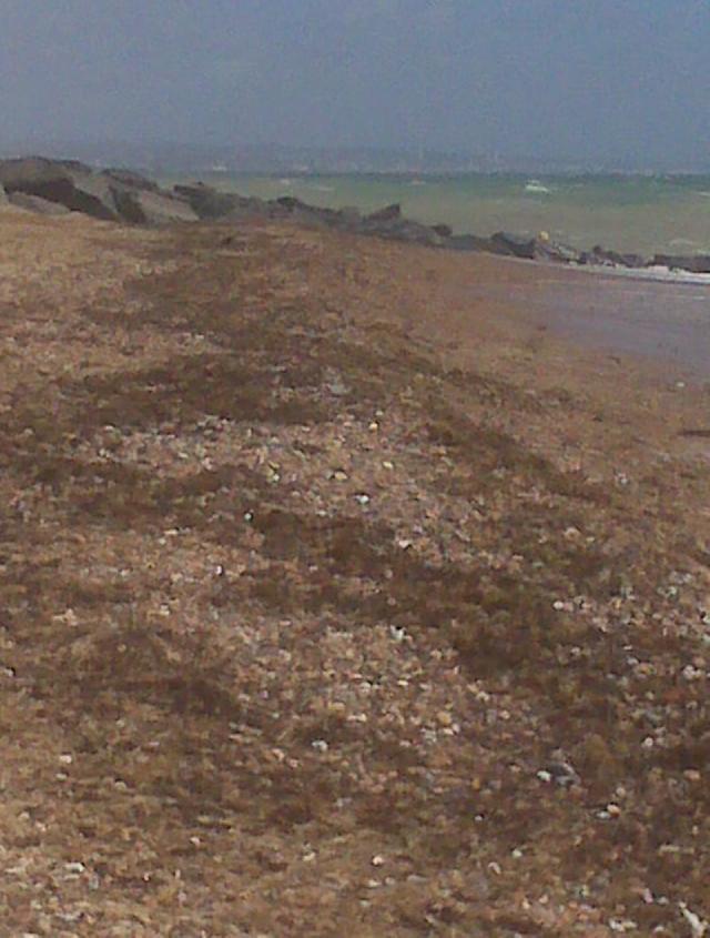
The bathing water is situated on the south coast in West Sussex, backed by an urban
area. The bathing water is primarily a shingle beach but with gently shelving sand
exposed at low water. Wooden groynes and boulder breakwaters protect the beach. Above
the bathing water is a line of beach huts with a large grassed area behind.
There is a surface water outfall below the high tide line 200m east of the sampling
point. This is believed to just drain the immediate surrounding area. There are several
storm overflows that discharge into the Teville Stream and the former East Worthing
sewage treatment works sea outfall (2km offshore) is now retained as a storm overflow.
Discharges occur when heavy rainfall overwhelms the sewerage system but are designed
not to affect bathing water compliance.
Prior to 2002, treated sewage was discharged from Worthing and Shoreham Long Sea Outfalls
(5 km and 7 km from the bathing water respectively). In 2002, East Worthing and Shoreham
sewage works were upgraded and the effluent is standard before being discharged through
the long sea outfalls.
Under the programme of works for Southern Water (from 2020 to 2022) investigations
within the catchment were carried out. This will help to identify where bathing water
improvements may be needed in the future.
In 2001, bacteriological tidal surveys suggested that the River Adur was a source
of contamination to the bathing water at certain states of tide under wet weather
conditions. A reduction in bathing water quality in 2013 has prompted further investigation.
At present the cause of the poor bathing water quality is unclear. The Environment
Agency undertook investigational sampling at Lancing between 2014 and 2017 bathing
water seasons to increase our knowledge and to try and identify possible sources of
contamination.
For the four year (2020-2023) assessment period where data is available, seaweed (macroalgae)
was not assessed as being sufficient to be objectionable, but was observed as being
present on 76% of visits. The bathing water can become covered with seaweed, depending
on tides and the weather. Groynes, rocks and other fixed objects may have a covering
of seaweed which can be slippery.
Modern sewerage systems have two separate systems, one takes foul sewage to sewage
treatment, the other takes rainwater runoff through surface water drains to rivers,
lakes and the sea. Misconnections occur when waste water pipes are plumbed into surface
water drains instead of the foul water sewerage system. This can give rise to pollution
when the waste water is discharged directly to the environment through the surface
water drain. For example, a washing machine or toilet may be incorrectly plumbed so
that it discharges to the surface drain rather than the foul sewage drain.
For the four year (2020-2023) assessment period where data is available, phytoplankton
(microscopic algae) was not assessed as being sufficient to be objectionable, but
was observed as being present on 3% of visits. Microscopic algae (phytoplankton) increase
in number at certain times of the year. This process is known as a phytoplankton bloom.
Blooms of phytoplankton can result in the water appearing discoloured or a foam forming
on the water.
The risks to human health from contact, ingestion or inhalation with marine algae
that currently occur in UK coastal waters are considered to be low. However, some
individuals may be more sensitive and display some reactions.
A common marine algae found in UK coastal waters is Phaeocystis, which is often mistaken
for sewage as it forms foam and a brown scum, but it is non-toxic.
This bathing water is subject to short term pollution procedures. The Environment
Agency makes a daily pollution risk forecast at this site based on the effects of
rain, tide, wind and seasonality on bathing water quality. These factors affect the
levels of bacteria that get washed into the sea from livestock, sewage and urban drainage
via rivers and streams and how they disperse.
When these factors combine to make short term pollution likely we issue a pollution
risk warning on this website and the beach manager will display a sign advising against
bathing at the bathing water. After a short term pollution event, levels of bacteria
typically return to normal after a day or so but it’s possible to have several warning
days in a row. Details of the work to reduce the sources of bacteria at this bathing
water are detailed in this profile.
In 2023 22 pollution risk warnings were issued for this bathing water.
All bathing waters have the potential to be affected by a pollution incident and if
this occurs a pollution risk warning will be issued with associated advice against
bathing on this website.
The River Adur enters the sea at Shoreham Harbour, 5 km to the east of the bathing
water. Also the Teville Stream enters the sea nearly 1 km to the west. Both could
occasionally be a source of contamination to the bathing water at certain states of
tide under wet weather conditions.
There is a high standard of treatment at the two sewage treatment works discharges
5 km and 7 km from the shore of this bathing water which are designed to protect bathing
water quality.
Environment Agency samplers make observations of litter present on the beach at every
visit, this includes assessments of sewage debris, litter and tar. At Lancing, Beach
Green for the four year (2020-2023) assessment period where data is available, sewage
debris was not noted at this site. Litter was not assessed as being sufficient to
be objectionable, but was observed as being present on 30% of visits. Tarry residue
was not noted at this site.
The bathing water is situated in a low lying area. The natural drainage (hydrological)
catchment into the bathing water is approximately 50 hectares and comprises just the
local urban area. There are no streams within the immediate beach vicinity but the
entrance to Shoreham Harbour is situated 5 km to the east and the Teville Stream enters
the sea nearly a km to the west. The wider surrounding area is predominantly rural
(arable and managed grassland) and most drainage in this area either enters into the
harbour through the River Adur or flows westwards towards the Teville Stream.
Seaweed (macroalgae) and phytoplankton (microscopic algae) are a natural part of the
marine and freshwater environment. Below we note whether these have been recorded
in quantities sufficient to be a nuisance.
The majority of sewers in England are “combined sewers” and carry both sewage and
surface water from roofs and drains. A storm overflow operates during heavy rainfall
when the sewerage system becomes overwhelmed by the amount of surface water. The overflow
prevents sewage from backing up pipes and flooding properties and gardens. An emergency
overflow will only operate infrequently, for example due to pump failure or blockage
in the sewerage system.
Heavy rain falling on pavements and roads often flows into surface water drains or
highway drains, ending up in local rivers and ultimately the sea. The quality of bathing
water may be adversely affected as a result of such events.
It is the Environment Agency role to drive improvement of water quality at bathing
waters that are at risk of failing higher standards. It is natural for water to run
off the land to the sea. Water quality at a bathing water is dependent upon the type
and area of land (the catchment) draining to the water and the activities undertaken
in that catchment.


