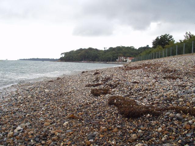
Seagrove is a small bay situated on the east coast of the Isle of Wight. Measuring
less than 1km in length, the bay slopes gently, with channels and sandbanks at low
tide. The beach is mainly sand. Two streams cross the beach and there is a sewage
overflow just offshore at the north end that could operate in response to significant
rainfall.
The Seagrove storm overflow is just offshore and the Seaview Esplanade storm overflow
is at the north end of the beach. These outfalls are designed to a once in five year
standard. These outfalls can discharge when heavy rainfall overwhelms the sewerage
system but are designed to ensure that bathing water compliance is not affected.
Substantial improvements were made to the sewerage system during 1990-1993 when local
sewage discharges were diverted to the Ryde Sea Outfall, the Seagrove storm outfall
was repaired and direct foul connections to it were connected to mains sewerage. Improvements
at three storm overflows in the area were completed during 200-2005. Diversion of
flows from Ryde Sea Outfall to Sandown sewage treatment works for treatment and discharge
via a new long sea outfall was completed prior to the 2001 bathing season.
Under the programme of works for Southern Water (from 2020 to 2022) investigations
within the catchment were carried out. This will help to identify where bathing water
improvements may be needed in the future.
A length of suspect sewer was sealed in June 1999 and follow-up tracer studies by
the Environment Agency confirmed that the work was effective in preventing leakage
to the surface water system.
For the four year (2020-2023) assessment period where data is available, seaweed (macroalgae)
was not assessed as being sufficient to be objectionable, but was observed as being
present on 80% of visits. The shore can become covered with seaweed, depending on
tides and the weather. Groynes, rocks and other fixed objects may have a covering
of seaweed which can be slippery.
Modern sewerage systems have two separate systems, one takes foul sewage to sewage
treatment, the other takes rainwater runoff through surface water drains to rivers,
lakes and the sea. Misconnections occur when waste water pipes are plumbed into surface
water drains instead of the foul water sewerage system. This can give rise to pollution
when the waste water is discharged directly to the environment through the surface
water drain. For example, a washing machine or toilet may be incorrectly plumbed so
that it discharges to the surface drain rather than the foul sewage drain.
For the four year (2020-2023) assessment period where data is available, phytoplankton
(microscopic algae) was not noted at this site.
The risks to human health from contact, ingestion or inhalation with marine algae
that currently occur in UK coastal waters are considered to be low. However, some
individuals may be more sensitive and display some reactions.
A common marine algae found in UK coastal waters is Phaeocystis, which is often mistaken
for sewage as it forms foam and a brown scum, but it is non-toxic.
The Environment Agency makes a daily pollution risk forecast at this site based on
the effects of rain, tide, wind and seasonality on bathing water quality. These factors
affect the levels of bacteria that get washed into the sea from livestock, sewage
and urban drainage via rivers and streams and how they disperse.
When these factors combine to cause a temporary reduction in water quality, we will
issue a pollution risk warning on this website. Water quality will typically return
to normal after a day or so, but it’s possible to have several warning days in a row.
Details of the work to reduce the sources of bacteria at this bathing water are detailed
in this profile.
In 2023 7 pollution risk warnings were issued for this bathing water.
All bathing waters have the potential to be affected by a pollution incident and if
this occurs a pollution risk warning will be issued with associated advice against
bathing on this website.
Environment Agency samplers make observations of litter present on the beach at every
visit, this includes assessments of sewage debris, litter and tar. At Seagrove for
the four year (2020-2023) assessment period where data is available, sewage debris
was not noted at this site. Litter was not assessed as being sufficient to be objectionable,
but was observed as being present on 54% of visits. Tarry residue was not assessed
as being sufficient to be objectionable, but was observed as being present on 2% of
visits.
The natural drainage (hydrological) catchment surrounding the bathing water is about
100 hectares. The catchment is mainly urban, but with a few fields.
Seaweed (macroalgae) and phytoplankton (microscopic algae) are a natural part of the
marine and freshwater environment. Below we note whether these have been recorded
in quantities sufficient to be a nuisance.
The majority of sewers in England are “combined sewers” and carry both sewage and
surface water from roofs and drains. A storm overflow operates during heavy rainfall
when the sewerage system becomes overwhelmed by the amount of surface water. The overflow
prevents sewage from backing up pipes and flooding properties and gardens. An emergency
overflow will only operate infrequently, for example due to pump failure or blockage
in the sewerage system.
Heavy rain falling on pavements and roads often flows into surface water drains or
highway drains, ending up in local rivers and ultimately the sea. The quality of bathing
water may be adversely affected as a result of such events.
It is the Environment Agency role to drive improvement of water quality at bathing
waters that are at risk of failing higher standards. It is natural for water to run
off the land to the sea. Water quality at a bathing water is dependent upon the type
and area of land (the catchment) draining to the water and the activities undertaken
in that catchment.


