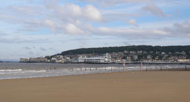
Weston-super-Mare Main is on the Somerset coast overlooking the Bristol Channel. It
is a sandy beach, approximately two kilometres wide, close to the town.
There is an emergency and storm overflow from the Knightstone pumping station that
discharges to the sea 1.2km north of the Environment Agency monitoring point. There
is an emergency and storm overflow from Weston-super-Mare STW that discharges to the
sea at Black Rock two kilometres south of the Environment Agency monitoring point.
The operation of the overflows can lead to a drop in bathing water quality
In the past this bathing water was affected by the outfall from the Weston-super-Mare
sewage treatment works (STW) that discharges at Black Rock. The Wessex Water sewage
treatment scheme for Weston-super-Mare, which provides secondary treatment and ultraviolet
(UV) disinfection, was completed in 2000. Additional improvements were made to the
sewerage system to reduce the frequency of storm and emergency overflows, particularly
at the Black Rock outfall.
In recent years further improvements have been made to reduce the frequency of storm
spillage at Black Rock and improve UV disinfection performance, this included increasing
storm sewage storage capacity at the STW and a scheme to reduce the volume of surface
water entering the sewerage system.
The Environment Agency have been working over a number of years to investigate sources
of pollution to this bathing water. Recent investigation work has been continuing
with Wessex Water as part of their investment programme. This includes a review of
sewerage performance within the Weston-Super-Mare area to determine what improvements,
if any, would be needed to improve bathing water quality further to secure a Good
Class and beyond to Excellent. These investigations include monitoring the quality
of discharges and modelling the potential impact on bathing water quality. This is
part of a National requirement on all Water Companies to better understand the impact
of their assets on bathing water quality and what future investment might be required
to meet Good and Excellent standards.
We also work with the Wessex Water and North Somerset Council to investigate, identify
and improve misconnections to the surface water system. During 2018 a contaminated
surface water discharge directly to the beach close to the compliance monitoring point
was identified and stopped prior to the start of the 2019 bathing season.
Since 2007 we have carried out extensive additional monitoring in the River Axe at
Brean Cross sluice and in the Uphill Great Rhyne at Uphill sluice alongside our routine
bathing water monitoring at Weston-Super-Mare. We have walked the catchment in wet
and dry weather conditions, and sampled various tributaries of the Uphill Great Rhyne.
The aim of these investigations is to help pinpoint pollution problems, and improve
bathing water quality. Monitoring of both rivers continues and signs of contamination
are investigated.
In 2021 and 2022 we undertook DNA analysis of water samples taken from the bathing
water and adjacent sites. This indicated that seagulls are a significant source of
poor bathing water quality at Weston Main.
The urban area of Weston-super-Mare immediately behind the beach is served by a combined
(surface and sewer) system. Surface water can flow into the River Axe and Uphill Great
rhyne from urban areas and highway drains. This can affect bathing water quality,
particularly after periods of rainfall. Wessex Water have regularly inspected and
sampled surface water outfalls.
For the four year (2020-2023) assessment period where data is available, seaweed (macroalgae)
was not assessed as being sufficient to be objectionable, but was observed as being
present on 71% of visits. The bathing water at Weston Main can become covered with
large amounts of seaweed, depending on tides and the weather. This bathing water does
not have a history of large amounts of seaweed because the beach is cleared by the
local authority.
Wrongly connected domestic waste water pipes can also affect the water quality of
the River Axe and Uphill Great Rhyne and therefore the bathing water. We have checked
the local sewerage system for misconnections. We will continue to work with Wessex
Water to identify and rectify any problems.
Modern sewerage systems have two separate systems, one takes foul sewage to sewage
treatment, the other takes rainwater runoff through surface water drains to rivers,
lakes and the sea. Misconnections occur when waste water pipes are plumbed into surface
water drains instead of the foul water sewerage system. This can give rise to pollution
when the waste water is discharged directly to the environment through the surface
water drain. For example, a washing machine or toilet may be incorrectly plumbed so
that it discharges to the surface drain rather than the foul sewage drain.
For the four year (2020-2023) assessment period where data is available, phytoplankton
(microscopic algae) was not noted at this site. Phytoplankton increase in number at
certain times of the year and this process is known as a phytoplankton bloom. These
blooms can discolour the water or form as a foam on the water. TheEnvironment Agency
research shows this bathing water does not have a history of phytoplankton blooms,
however, a light brown foam sometimes appears at this beach which is due to the break
down of macro algae.
The risks to human health from contact, ingestion or inhalation with marine algae
that currently occur in UK coastal waters are considered to be low. However, some
individuals may be more sensitive and display some reactions.
A common marine algae found in UK coastal waters is Phaeocystis, which is often mistaken
for sewage as it forms foam and a brown scum, but it is non-toxic.
This bathing water is subject to short term pollution procedures. The Environment
Agency makes a daily pollution risk forecast at this site based on the effects of
rain, wind and seasonality on bathing water quality. These factors affect the levels
of bacteria that get washed into the sea from livestock, sewage and urban drainage
via rivers and streams and how they disperse.
When these factors combine to make short term pollution likely we issue a pollution
risk warning on this website and the beach manager will display a sign advising against
bathing at the bathing water. After a short term pollution event, levels of bacteria
typically return to normal after a day or so but it’s possible to have several warning
days in a row. Details of the work to reduce the sources of bacteria at this bathing
water are detailed in this profile.
In 2023 78 pollution risk warnings were issued for this bathing water.
All bathing waters have the potential to be affected by a pollution incident and if
this occurs a pollution risk warning will be issued with associated advice against
bathing on this website.
A step change improvement in water quality has been identified from 1st May 2019 at
Weston Main due to pollution prevention work eliminating contaminated discharges from
a nearby surface water outfall. Bathing water quality monitoring samples collected
prior to this date shall not be used for classification.
The River Axe flows into the sea at the southern end of the beach. There are also
two small drains that flow into the sea near the River Axe. The Uphill Great Rhyne,
controlled by a sluice gate, joins the River Axe approximately 500m before it reaches
the sea. The Environment Agency has monitored the water quality of the Uphill Great
Rhyne and the River Axe since 2007. During and after periods of heavy rainfall, agricultural
and urban runoff to the River Axe and the Uphill Great Rhyne increases, impacting
bathing water quality at Weston Main.
The outfall from Weston-super-Mare STW discharges to the sea at Black Rock two kilometres
south of the Environment Agency monitoring point. This discharge is disinfected and
designed to protect bathing water quality.
Environment Agency samplers make observations of litter present on the beach at every
visit, this includes assessments of sewage debris, litter and tar. At Weston Main
for the four year (2020-2023) assessment period where data is available, sewage debris
was not assessed as being sufficient to be objectionable, but was observed as being
present on 5% of visits. Litter was assessed as being sufficient to be objectionable
for 5% of visits, with 85% of visits noting the presence of litter. Tarry residue
was not noted at this site.
There are more than 50 farms in the bathing water catchment. During and after periods
of heavy rainfall, runoff from agricultural land is greatly increased, and the quality
of the bathing water can be reduced.
The Environment Agency are working with Natural England and farmers on Catchment Sensitive
Farming programmes to encourage better farming practices and improve water quality
in the surrounding areas.
The Uphill Great Rhyne flows (mostly underground) through a large commercial estate
which includes some light industry. If any concerns arise, the Environment Agency
will investigate and request immediate remedial action from those responsible.
There are caravan parks and houses that are not on the main sewerage system and have
private sewage treatment arrangements. If any concerns arise, the Environment Agency
will investigate and request immediate remedial action from those responsible.
The catchment surrounding Weston Main is approximately 24,000 hectares, and includes
the River Axe and its tributaries the Cheddar Yeo and Lox Yeo. These watercourses
rise from limestone springs on the Mendip Hills at Wookey Hole Caves, and flow through
the Somerset Levels and Moors to the sea in Weston Bay just north of Brean Down.
The rivers are interconnected in several places by drainage channels (known locally
as rhynes) controlled by sluices, forming a very complex artificial drainage system.
The River Axe is also controlled by a sluice gate approximately 2.7km from the Bristol
Channel. The sluices affect the amount of freshwater entering the sea from the River
Axe. The majority of the land is used for large scale agriculture, with more than
50 farms.
Seaweed (macroalgae) and phytoplankton (microscopic algae) are a natural part of the
marine and freshwater environment. Below we note whether these have been recorded
in quantities sufficient to be a nuisance.
The majority of sewers in England are “combined sewers” and carry both sewage and
surface water from roofs and drains. A storm overflow operates during heavy rainfall
when the sewerage system becomes overwhelmed by the amount of surface water. The overflow
prevents sewage from backing up pipes and flooding properties and gardens. An emergency
overflow will only operate infrequently, for example due to pump failure or blockage
in the sewerage system.
Heavy rain falling on pavements and roads often flows into surface water drains or
highway drains, ending up in local rivers and ultimately the sea. The quality of bathing
water may be adversely affected as a result of such events.
It is the Environment Agency role to drive improvement of water quality at bathing
waters that are at risk of failing higher standards. It is natural for water to run
off the land to the sea. Water quality at a bathing water is dependent upon the type
and area of land (the catchment) draining to the water and the activities undertaken
in that catchment.


