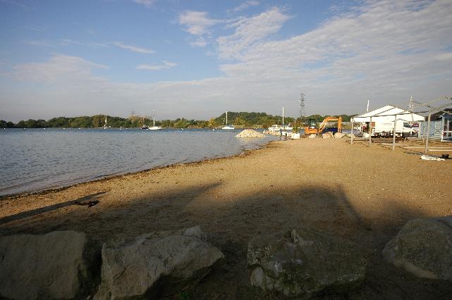
Poole Harbour Rockley Sands is in Poole Harbour on the Dorset coast. It is a small
sand and mud beach, approximately 300 metres wide, at the mouth of the Rock Lea River.
This bathing water is included in the Surfers Against Sewage “Safer Seas Service”.
This service can alert you to Combined Storm Sewer Overflow discharges via a phone
App and in addition, it includes the Environment Agency Pollution Risk Forecast warnings
where they are available. Further details of the service can be found at - http://www.sas.org.uk/safer-seas-service/
The storm overflow at the Kings Arms pumping station in Stoborough was improved by
Wessex Water in February 2002. The sewage treatment works (STWs) at Poole, Wareham
and Lytchett Minster were upgraded with ultraviolet disinfection by April 2003. The
storm overflow in Upton (Moorlands Way) and five other storm overflows to Poole Harbour
were also improved at that time.
Holton Heath STW was closed in 2013 and effluent is now pumped to Wareham STW.
A storm overflow at Sandy Lane which discharges close to Rockley Sands will be improved
to reduce spill frequency. This improvement is due to be completed by March 2025
For the four year (2020-2023) assessment period where data is available, seaweed (macroalgae)
was not assessed as being sufficient to be objectionable, but was observed as being
present on 94% of visits. This bathing water does not have a history of large amounts
of seaweed (macro algae).
For the four year (2020-2023) assessment period where data is available, phytoplankton
(microscopic algae) was not assessed as being sufficient to be objectionable, but
was observed as being present on 2% of visits. Phytoplankton (microscopic algae) naturally
increase in number at certain times of the year. This process is known as a phytoplankton
bloom. This bathing water does not have a history of phytoplankton blooms.
The risks to human health from contact, ingestion or inhalation with marine algae
that currently occur in UK coastal waters are considered to be low. However, some
individuals may be more sensitive and display some reactions.
A common marine algae found in UK coastal waters is Phaeocystis, which is often mistaken
for sewage as it forms foam and a brown scum, but it is non-toxic.
The Environment Agency makes a daily pollution risk forecast at this site based on
the effects of rain, tide, wind and sunlight on bathing water quality. These factors
affect the levels of bacteria that get washed into the sea from livestock, sewage
and urban drainage via rivers and streams and how they disperse.
When these factors combine to cause a temporary reduction in water quality, we will
issue a pollution risk warning on this website. Water quality will typically return
to normal after a day or so, but it’s possible to have several warning days in a row.
Details of the work to reduce the sources of bacteria at this bathing water are detailed
in this profile.
In 2023 3 pollution risk warnings were issued for this bathing water.
All bathing waters have the potential to be affected by a pollution incident and if
this occurs a pollution risk warning will be issued with associated advice against
bathing on this website.
Streams and rivers are typically affected by human sewage, animal slurry and runoff
from roads. The Sherford River enters Lytchett Bay north of the beach.
Sewage from the Poole area is pumped to Poole STW. The outfall from Poole STW discharges
to Holes Bay in Poole Harbour. This discharge is disinfected and designed to protect
bathing water quality.
Environment Agency samplers make observations of litter present on the beach at every
visit, this includes assessments of sewage debris, litter and tar. At Poole Harbour
Rockley Sands for the four year (2020-2023) assessment period where data is available,
sewage debris was not noted at this site. Litter was assessed as being sufficient
to be objectionable for 15% of visits, with 76% of visits noting the presence of litter.
Tarry residue was not noted at this site.
There is a surface water outfall from the Rockley Boat Park at SY9733091160 which
discharges 100m from the Environment Agency monitoring point. If any concerns arise,
the Environment Agency will investigate and request immediate remedial action from
those responsible.
The catchment surrounding Poole Harbour Rockley Sands is approximately 86,500 hectares
and includes the rivers Piddle, Frome, Corfe, and Sherford. These rivers drain from
the Dorset Downs and flow into Poole Harbour which is one of the largest and shallowest
natural harbours in the world.
The Piddle and Frome are approximately 30 kilometres (km) and 43km long respectively
and flow to Wareham, where they both enter Poole Harbour via Wareham Channel. The
River Corfe is approximately 11km long (including tributaries) and flows parallel
to the Purbeck ridge to Corfe Castle. It is joined by a number of streams before entering
the harbour through the Wych Channel. The River Sherford is approximately 12km long
and flows from Bere Regis in the Wareham Forest to Lytchett Bay on the northern side
of Poole Harbour.
The steep slopes at the top of the catchment mean rain runs off rapidly into the rivers.
Further down the catchment the valleys broaden and there is a more gradual response
to rainfall runoff. The majority of the land in the catchment is agricultural with
mixed livestock and arable. The urban area of Poole surrounds the bathing water and
includes caravan parks and recreational areas.
Seaweed (macroalgae) and phytoplankton (microscopic algae) are a natural part of the
marine and freshwater environment. Below we note whether these have been recorded
in quantities sufficient to be a nuisance.
The majority of sewers in England are “combined sewers” and carry both sewage and
surface water from roofs and drains. A storm overflow operates during heavy rainfall
when the sewerage system becomes overwhelmed by the amount of surface water. The overflow
prevents sewage from backing up pipes and flooding properties and gardens. An emergency
overflow will only operate infrequently, for example due to pump failure or blockage
in the sewerage system.
Heavy rain falling on pavements and roads often flows into surface water drains or
highway drains, ending up in local rivers and ultimately the sea. The quality of bathing
water may be adversely affected as a result of such events.
It is the Environment Agency role to drive improvement of water quality at bathing
waters that are at risk of failing higher standards. It is natural for water to run
off the land to the sea. Water quality at a bathing water is dependent upon the type
and area of land (the catchment) draining to the water and the activities undertaken
in that catchment.


