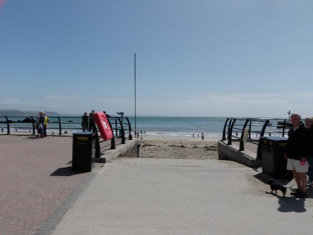
East Looe is at the mouth of the Looe Estuary on the south coast of Cornwall. It is
a sand and rock beach resort, approximately 280 metres wide, close to the town of
Looe.
There are emergency and storm overflows that discharge into the estuary at Looe, and
the river catchment upstream. The operation of the overflows can lead to a temporary
drop in water quality in the Looe Estuary and at East Looe bathing water.
This bathing water is included in the Surfers Against Sewage “Safer Seas Service”.
This service can alert you to Combined Storm Sewer Overflow discharges via a phone
App and in addition, it includes the Environment Agency Pollution Risk Forecast warnings
where they are available. Further details of the service can be found at - http://www.sas.org.uk/safer-seas-service/
The sewage treatment scheme for East Looe which provides secondary treatment and ultraviolet
(UV) disinfection, was completed by South West Water in late 1998. Extensive sewer
rehabilitation works were also carried out at that time. Improvements to many combined
sewer overflows (CSO) in East Looe were completed by the end of March 2000. By March
2006 improvements were completed to the continuous discharge and two intermittent
discharges at the Liskeard (Lodge Hill) sewage treatment works (STW).
Storm overflow event duration monitoring (EDM) was installed at four CSOs in East
Looe by December 2011. In 2015, South West Water completed further improvements to
urban drainage and sewage management in Liskeard and Looe. The improvements concentrated
on reducing the frequency of storm discharges, and increasing sewage treatment capacity.
The work also addressed misconnections and leaks through old sewers along with saline
intrusion and sewer flooding on spring tides.
Investigative monitoring has shown that the main sources of pollution impacting the
bathing water are urban drainage and sewage from Liskeard and Looe, and agricultural
run-off from the East Looe River catchment. This is known because the Environment
Agency has carried out extensive monitoring upstream and downstream of potential source
sites and used DNA tracing techniques to identify the relative contribution from agriculture
and sewage.
The urban area of East Looe immediately behind the beach is served by a combined (surface
and sewer) system. There are no outfalls from the system onto the beach. The Environment
Agency have regularly inspected and sampled surface water outfalls.
For the four year (2020-2023) assessment period where data is available, seaweed (macroalgae)
was assessed as being sufficient to be objectionable for 18% of visits, with 72% of
visits noting the presence of seaweed (macroalgae). This bathing water can have moderate
amounts of seaweed (macro algae) in the water column following storms. Seaweed washed
up onto the beach is regularly moved to the back of the beach by the beach manager.
Wrongly connected domestic waste water pipes can also affect the bathing water quality.
We have checked the local sewerage system for misconnections. We are working with
Cornwall County Council and South West Water to identify and rectify any problems
when they arise.
Modern sewerage systems have two separate systems, one takes foul sewage to sewage
treatment, the other takes rainwater runoff through surface water drains to rivers,
lakes and the sea. Misconnections occur when waste water pipes are plumbed into surface
water drains instead of the foul water sewerage system. This can give rise to pollution
when the waste water is discharged directly to the environment through the surface
water drain. For example, a washing machine or toilet may be incorrectly plumbed so
that it discharges to the surface drain rather than the foul sewage drain.
For the four year (2020-2023) assessment period where data is available, phytoplankton
(microscopic algae) was not noted at this site. Phytoplankton (microscopic algae)
naturally increase in number at certain times of the year. This process is known as
a phytoplankton bloom. This bathing water is occasionally impacted by phytoplankton
blooms.
The risks to human health from contact, ingestion or inhalation with marine algae
that currently occur in UK coastal waters are considered to be low. However, some
individuals may be more sensitive and display some reactions.
A common marine algae found in UK coastal waters is Phaeocystis, which is often mistaken
for sewage as it forms foam and a brown scum, but it is non-toxic.
This bathing water is subject to short term pollution procedures. The Environment
Agency makes a daily pollution risk forecast at this site based on the effects of
rain, tide, wind and sunlight on bathing water quality. These factors affect the levels
of bacteria that get washed into the sea from livestock, sewage and urban drainage
via rivers and streams and how they disperse.
When these factors combine to make short term pollution likely we issue a pollution
risk warning on this website and the beach manager will display a sign advising against
bathing at the bathing water. After a short term pollution event, levels of bacteria
typically return to normal after a day or so but it’s possible to have several warning
days in a row. Details of the work to reduce the sources of bacteria at this bathing
water are detailed in this profile.
In 2023 22 pollution risk warnings were issued for this bathing water.
All bathing waters have the potential to be affected by a pollution incident and if
this occurs a pollution risk warning will be issued with associated advice against
bathing on this website.
A step change improvement in water quality has been identified in 2015, from 30/04/2015,
due to improvements made to Water plc assets. Any monitoring samples collected prior
to this date shall not be used for classification.
Streams and rivers are typically affected by human sewage, animal slurry and runoff
from roads. East Looe beach is next to the mouth of the Looe Estuary which is formed
where the East and West Looe rivers flow into the sea. The Environment Agency have
monitored the East Looe River at the beach since 1987, and found that water quality
in the estuary is temporarily worse during and after heavy rainfall.
The outfall from the Liskeard STW discharges into the East Looe River 11km from the
bathing water. The outfall from the Looe STW discharges into the East Looe River 2.3km
from the bathing water. Both these discharges are Ultraviolet disinfected, and designed
to protect bathing water quality.
Environment Agency samplers make observations of litter present on the beach at every
visit, this includes assessments of sewage debris, litter and tar. At East Looe for
the four year (2020-2023) assessment period where data is available, sewage debris
was not noted at this site. Litter was assessed as being sufficient to be objectionable
for 2% of visits, with 57% of visits noting the presence of litter. Tarry residue
was not noted at this site.
The catchment of the East Looe bathing water is largely agricultural with significant
areas of land used for livestock. During and after periods of heavy rainfall, runoff
to the Looe River from agricultural land is greatly increased, and the quality of
the bathing water can be reduced.
The Environment Agency are working with Natural England, Cornwall Wildlife Trust and
farmers to encourage better farming practices and improve water quality in the surrounding
areas. A programme of farm improvements have been undertaken throughout the catchment
to help reduce the impact of farming on water quality at the bathing water.
The catchment surrounding East Looe is approximately 10,700 hectares. The River Looe
has two main branches, the East and the West Looe rivers, which drain from the southern
slopes of Bodmin Moor to the coast. The eastern branch is approximately 16 kilometres
(km) long. It starts near St Cleer and flows south, passing close to the western outskirts
of Liskeard. The western branch is approximately 14km long and starts near Dobwalls.
There are many tributaries which flow to meet these main branches which increases
the length of stream in the catchment significantly. The lower reaches of the two
rivers form the Looe Estuary and come together as they flow through the town. From
the headwaters to the estuary, both rivers fall steeply and are subject to rapid changes
in water levels after periods of rainfall.
It is a rural area, ranging from open moorland to rolling hills with steep-sided river
valleys running across them In the past there was extensive mining activity in the
north of the catchment, which has left a legacy of abandoned mines and workings.
There are mostly grassland fields in the upper reaches of the catchment giving way
to more arable land in the south of the catchment. The steep river valleys are often
heavily wooded. Urban areas include Liskeard, Dobwalls, Duloe and Looe. There are
holiday parks and campsites in the catchment concentrated at the coast around Looe.
Seaweed (macroalgae) and phytoplankton (microscopic algae) are a natural part of the
marine and freshwater environment. Below we note whether these have been recorded
in quantities sufficient to be a nuisance.
The majority of sewers in England are “combined sewers” and carry both sewage and
surface water from roofs and drains. A storm overflow operates during heavy rainfall
when the sewerage system becomes overwhelmed by the amount of surface water. The overflow
prevents sewage from backing up pipes and flooding properties and gardens. An emergency
overflow will only operate infrequently, for example due to pump failure or blockage
in the sewerage system.
Heavy rain falling on pavements and roads often flows into surface water drains or
highway drains, ending up in local rivers and ultimately the sea. The quality of bathing
water may be adversely affected as a result of such events.
It is the Environment Agency role to drive improvement of water quality at bathing
waters that are at risk of failing higher standards. It is natural for water to run
off the land to the sea. Water quality at a bathing water is dependent upon the type
and area of land (the catchment) draining to the water and the activities undertaken
in that catchment.


