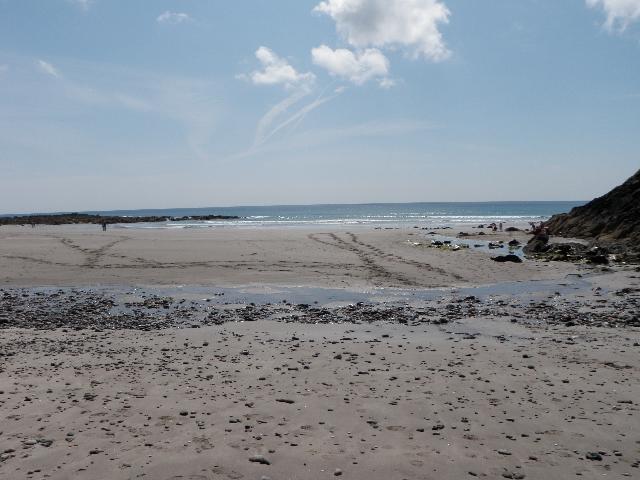
Kennack Sands is on the south coast of Cornwall. It is a rural sandy cove, approximately
250 metres wide, backed by sand dunes. A stream flows onto the beach and spreads out
over the sand.
For the four year (2020-2023) assessment period where data is available, seaweed (macroalgae)
was assessed as being sufficient to be objectionable for 7% of visits, with 90% of
visits noting the presence of seaweed (macroalgae). This bathing water does not have
a history of large amounts of seaweed (macro algae).
For the four year (2020-2023) assessment period where data is available, phytoplankton
(microscopic algae) was not assessed as being sufficient to be objectionable, but
was observed as being present on 4% of visits. Phytoplankton (microscopic algae) naturally
increase in number at certain times of the year. This process is known as a phytoplankton
bloom. This bathing water does not have a history of phytoplankton blooms.
The risks to human health from contact, ingestion or inhalation with marine algae
that currently occur in UK coastal waters are considered to be low. However, some
individuals may be more sensitive and display some reactions.
A common marine algae found in UK coastal waters is Phaeocystis, which is often mistaken
for sewage as it forms foam and a brown scum, but it is non-toxic.
This bathing water is subject to short term pollution procedures. The Environment
Agency makes a daily pollution risk forecast at this site based on the effects of
rain, sunlight and seasonality on bathing water quality. These factors affect the
levels of bacteria that get washed into the sea from livestock, sewage and urban drainage
via rivers and streams and how they disperse.
When these factors combine to make short term pollution likely we issue a pollution
risk warning on this website and the beach manager will display a sign advising against
bathing at the bathing water. After a short term pollution event, levels of bacteria
typically return to normal after a day or so but it’s possible to have several warning
days in a row. Details of the work to reduce the sources of bacteria at this bathing
water are detailed in this profile.
In 2023 1 pollution risk warnings were issued for this bathing water.
All bathing waters have the potential to be affected by a pollution incident and if
this occurs a pollution risk warning will be issued with associated advice against
bathing on this website.
Streams and rivers are typically affected by human sewage, animal slurry and runoff
from roads. There are two streams that flow onto Kennack Sands, We have monitored
the streams between 1986 and 2008, and found that water quality is temporarily worse
during and after heavy rainfall.
Environment Agency samplers make observations of litter present on the beach at every
visit, this includes assessments of sewage debris, litter and tar. At Kennack Sands
for the four year (2020-2023) assessment period where data is available, sewage debris
was not noted at this site. Litter was not assessed as being sufficient to be objectionable,
but was observed as being present on 43% of visits. Tarry residue was not noted at
this site.
There are four farms in the catchment. During and after periods of heavy rainfall,
runoff to the streams from agricultural land is greatly increased, and the quality
of the bathing water can be reduced.
There are caravan parks and hotels that are not on the main sewerage system and have
private sewage treatment arrangements. The Environment Agency do not believe these
are a source of pollution to the bathing water. If any concerns arise, the Environment
Agency will investigate and request immediate remedial action from those responsible.
The catchment surrounding Kennack Sands is approximately 775 hectares. There are two
separate streams which flow to the beach with a combined length of approximately seven
kilometres. The Kuggar Stream is approximately two and a half kilometres long and
enters the sea at the centre of the beach. The Kennack Stream is approximately three
and a half kilometres long. It rises in the Goonhilly Downs and flows south to the
sea at the north eastern end of the bathing water. This catchment slopes gently from
north to south and becomes steeper at the coast. The steep slopes in the lower catchment
mean rain runs off rapidly into the stream.
Most of the catchment is natural heath land which forms part of the Lizard Special
Area of Conservation (SAC) and Goonhilly Downs Site of Special Scientific Interest
(SSSI). The remainder is made up of pockets of arable, improved grassland and woodland
with approximately four farms and five camping and caravan sites. The catchment is
in the Cornwall Area of Outstanding Natural Beauty (AONB).
Seaweed (macroalgae) and phytoplankton (microscopic algae) are a natural part of the
marine and freshwater environment. Below we note whether these have been recorded
in quantities sufficient to be a nuisance.
The majority of sewers in England are “combined sewers” and carry both sewage and
surface water from roofs and drains. A storm overflow operates during heavy rainfall
when the sewerage system becomes overwhelmed by the amount of surface water. The overflow
prevents sewage from backing up pipes and flooding properties and gardens. An emergency
overflow will only operate infrequently, for example due to pump failure or blockage
in the sewerage system.
Heavy rain falling on pavements and roads often flows into surface water drains or
highway drains, ending up in local rivers and ultimately the sea. The quality of bathing
water may be adversely affected as a result of such events.
It is the Environment Agency role to drive improvement of water quality at bathing
waters that are at risk of failing higher standards. It is natural for water to run
off the land to the sea. Water quality at a bathing water is dependent upon the type
and area of land (the catchment) draining to the water and the activities undertaken
in that catchment.


