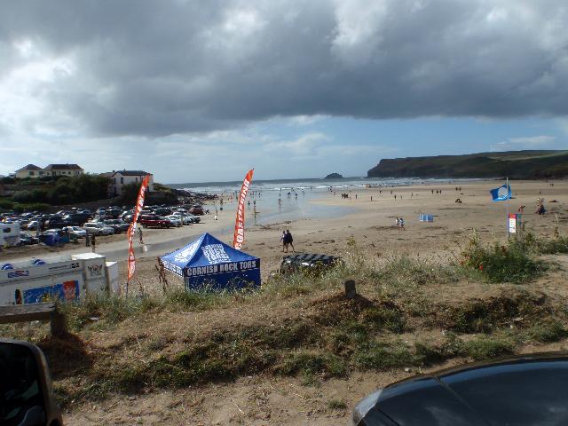
Polzeath Beach is just north of the Camel Estuary on the north coast of Cornwall.
It is a sandy beach resort, approximately 640 metres wide, with a stream flowing across
it. The beach is backed by cliffs and there are plenty of rock pools.
There is an emergency/storm overflow from the Polzeath pumping station that discharges
to the Polzeath Brook 250m from the Environment Agency monitoring point. There is
also an emergency/storm overflow from the New Polzeath pumping station, that discharges
to the sea 500m from the Environment Agency monitoring point.
The operation of the overflows can lead to a temporary drop in water quality in the
Polzeath Brook and Polzeath bathing water.
This bathing water is included in the Surfers Against Sewage “Safer Seas Service”.
This service can alert you to Combined Storm Sewer Overflow discharges via a phone
App and in addition, it includes the Environment Agency Pollution Risk Forecast warnings
where they are available. Further details of the service can be found at - http://www.sas.org.uk/safer-seas-service/
The South West Water sewage treatment scheme known as the Trevone Scheme collects
sewage from the various settlements around the Camel Estuary. It is split into two
schemes centred on the Porthilly sewage treatment works (STW) (East Bank Scheme),
and a works at Trecerus near Padstow (West Bank Scheme).
Porthilly STW received ultraviolet (UV) disinfection in 1996 for sewage from Rock,
Polzeath, and Tredrizzick, and improvements were made to the sewerage in Rock and
Polzeath. Trecerus STW was completed for the 1997 bathing season with chemically assisted
sedimentation and UV disinfection for sewage from St Merryn, Trevone and Padstow.
Improvements were also made to the sewerage in Padstow, St Merryn, Harlyn and Trevone
at that time. The treatment was subsequently upgraded to full secondary treatment
and UV disinfection by April 2004.
Improvements to seven storm overflows to the Camel Estuary at Padstow Harbour, Rock
pumping station (PS), Eddystone Road (Wadebridge PS), and Porthilly combined sewer
overflow (CSO) were also completed by April 2004, and improvements to Padstow South
Quay CSO, Moyles Road and Egloshayle PS were completed by August 2004. The installation
of UV disinfection at Wadebridge STW was completed by July 2004.
Storm overflow event duration monitoring (EDM) was installed at Moyles Road, Padstow
Foreshore and at the Rock, Porthilly Cove, Padstow Harbour, Tredrizzick, Rosebarrow
Farm, Polzeath, and New Polzeath pumping stations by December 2011.
The Environment Agency have regularly carried out stream monitoring alongside routine
bathing water sampling. In 2018 very high levels of bacteria were detected in the
Polzeath Brook and DNA analysis showed the source to be human in origin. Further water
quality sampling and the deployment of an in-situ water quality monitor traced the
source to a contaminated surface water drain. Investigations revealed two holiday
properties whose foul drainage had been misconnected into the surface water system.
These were rectified in the autumn of 2018.
The Environment Agency have worked with Cornwall Council beach rangers at Polzeath.
We supplied them with test kits to carry out daily checks on the two streams. The
aim of this was to give us early warning of any potential pollution problems that
could impact bathing water quality.
For the four year (2020-2023) assessment period where data is available, seaweed (macroalgae)
was assessed as being sufficient to be objectionable for 10% of visits, with 81% of
visits noting the presence of seaweed (macroalgae). This bathing water does not have
a history of large amounts of seaweed (macro algae).
Wrongly connected domestic waste water pipes can also affect the bathing water quality.
Modern sewerage systems have two separate systems, one takes foul sewage to sewage
treatment, the other takes rainwater runoff through surface water drains to rivers,
lakes and the sea. Misconnections occur when waste water pipes are plumbed into surface
water drains instead of the foul water sewerage system. This can give rise to pollution
when the waste water is discharged directly to the environment through the surface
water drain. For example, a washing machine or toilet may be incorrectly plumbed so
that it discharges to the surface drain rather than the foul sewage drain.
For the four year (2020-2023) assessment period where data is available, phytoplankton
(microscopic algae) was assessed as being sufficient to be objectionable for 2% of
visits, with 2% of visits noting the presence of phytoplankton (microscopic algae).
Phytoplankton (microscopic algae) naturally increase in number at certain times of
the year. This process is known as a phytoplankton bloom. This bathing water does
not have a history of phytoplankton blooms.
The risks to human health from contact, ingestion or inhalation with marine algae
that currently occur in UK coastal waters are considered to be low. However, some
individuals may be more sensitive and display some reactions.
A common marine algae found in UK coastal waters is Phaeocystis, which is often mistaken
for sewage as it forms foam and a brown scum, but it is non-toxic.
This bathing water is subject to short term pollution procedures. The Environment
Agency makes a daily pollution risk forecast at this site based on the effects of
rain, tide and seasonality on bathing water quality. These factors affect the levels
of bacteria that get washed into the sea from livestock, sewage and urban drainage
via rivers and streams and how they disperse.
When these factors combine to make short term pollution likely we issue a pollution
risk warning on this website and the beach manager will display a sign advising against
bathing at the bathing water. After a short term pollution event, levels of bacteria
typically return to normal after a day or so but it’s possible to have several warning
days in a row. Details of the work to reduce the sources of bacteria at this bathing
water are detailed in this profile.
In 2023 2 pollution risk warnings were issued for this bathing water.
All bathing waters have the potential to be affected by a pollution incident and if
this occurs a pollution risk warning will be issued with associated advice against
bathing on this website.
Streams and rivers are typically affected by human sewage, animal slurry and runoff
from roads. The Polzeath Brook and Trenant Stream both flow across this beach. The
Environment Agency have regularly monitored the Polzeath Brook and found that it can
affect water quality after heavy rainfall.
Sewage from Polzeath is pumped to Porthilly STW for treatment. The outfall from the
Porthilly STW discharges to the River Camel Estuary approximately 5.2km from the bathing
water. This discharge is disinfected and designed to protect bathing water quality.
Environment Agency samplers make observations of litter present on the beach at every
visit, this includes assessments of sewage debris, litter and tar. At Polzeath for
the four year (2020-2023) assessment period where data is available, sewage debris
was not noted at this site. Litter was assessed as being sufficient to be objectionable
for 2% of visits, with 60% of visits noting the presence of litter. Tarry residue
was not noted at this site.
There are farms in the immediate bathing water catchment, most of which are dairy
and arable. During and after periods of heavy rainfall, runoff to the Polzeath Brook
and Trenant Stream from agricultural land is greatly increased, and the quality of
the bathing water can be reduced.
There are caravan parks and hotels that are not on the main sewerage system and have
private sewage treatment arrangements. The Environment Agency do not believe these
are a source of pollution to the bathing water. If any concerns arise, the Environment
Agency will investigate and request immediate remedial action from those responsible.
The catchment surrounding Polzeath is approximately 40,900 hectares and includes the
Camel Estuary. Polzeath bathing water is influenced by the Camel Estuary system, the
Polzeath Brook, and the Trenant Stream. The Polzeath Brook is approximately four and
a half kilometres (km) long and flows from the village of St Minver through farmland
and a caravan site at Polzeath village before flowing across the beach. The Trenant
Stream is 900m long and joins the Polzeath Brook 60m upstream of the beach. There
is also a small stream one and a half kilometres long, which flows from the settlement
of Pentireglaze to the northern end of Polzeath beach. The steep catchment means rain
runs off rapidly into the streams.
The River Camel rises at 280m on Hendraburnick Down on Bodmin Moor, and drains the
area between Bodmin Moor and Padstow including a diverse range of farming landscapes.
It flows for approximately 40km over steep terrain before joining the estuary near
Wadebridge. The estuary then meets the sea near Padstow.
The Camel Valley and its major tributaries the rivers Allen, Ruthern and De Lank are
currently designated as a Site of Special Scientific Interest (SSSI). They have also
been attributed Special Area of Conservation (SAC) status under the European Union
Habitats Directive, due to the presence of otters and bullheads. Further designations
include Area of Outstanding Natural Beauty (AONB) status for the Camel Estuary and
Area of Great Landscape Value (AGLV) status for the Camel and Allen valleys.
Historically, mining and quarrying were important industries with slate quarrying
still occurring at Delabole, towards the top of the River Allen. The upper and middle
reaches of the Camel are essentially moorland, passing into woodland. Most of the
undulating land is used for livestock farming, with mixed farming/rough grazing on
the poorer land. The catchment includes the larger settlements of Bodmin, Wadebridge,
Padstow and Camelford.
Seaweed (macroalgae) and phytoplankton (microscopic algae) are a natural part of the
marine and freshwater environment. Below we note whether these have been recorded
in quantities sufficient to be a nuisance.
The majority of sewers in England are “combined sewers” and carry both sewage and
surface water from roofs and drains. A storm overflow operates during heavy rainfall
when the sewerage system becomes overwhelmed by the amount of surface water. The overflow
prevents sewage from backing up pipes and flooding properties and gardens. An emergency
overflow will only operate infrequently, for example due to pump failure or blockage
in the sewerage system.
Heavy rain falling on pavements and roads often flows into surface water drains or
highway drains, ending up in local rivers and ultimately the sea. The quality of bathing
water may be adversely affected as a result of such events.
It is the Environment Agency role to drive improvement of water quality at bathing
waters that are at risk of failing higher standards. It is natural for water to run
off the land to the sea. Water quality at a bathing water is dependent upon the type
and area of land (the catchment) draining to the water and the activities undertaken
in that catchment.


