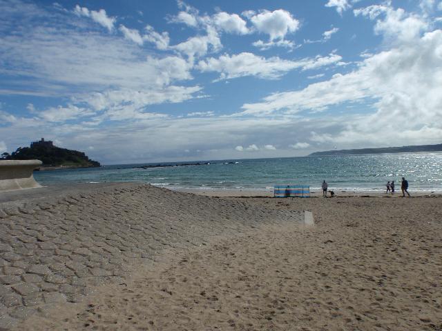
Mounts Bay is on the south coast of Cornwall. There are four designated bathing waters
located around the bay - Wherry Town, Penzance, Long Rock and Marazion. All the beaches
are sandy resorts backed by sea defences. Marazion beach is approximately 880 metres
wide. The Red River flows onto the centre of Marazion beach.
In the past there were a number of private discharges and combined sewer overflows
(CSO) that affected this bathing water, as well as the general contamination of Penzance
Bay from numerous sources. The sewage treatment scheme for Penzance and St Ives was
completed by South West Water in early 1995.
The scheme included extensive sewerage, improvements to intermittent discharges and
the removal of untreated sewage discharges. Wastewater from St Ives is pumped to Hayle
sewage treatment works (STW), where it receives secondary treatment before its discharge
through a 2.7km long sea outfall west of Godrevy Head. The Hayle STW was enlarged
and upgraded in 1995 and again in 2000. In 1998, further improvements were also made
to CSOs at Long Rock, and Marazion pumping station CSO was sealed in November 2001.
The Environment Agency have carried out additional catchment monitoring throughout
the Penzance/Marazion area of Mounts Bay alongside the Environment Agency routine
bathing water monitoring. The Environment Agency have used a DNA tracing technique
to help us identify whether sources of faecal pollution are animal or human with surveys
carried out in wet and dry weather conditions.
These studies have shown that water quality in the Marazion River and Marazion bathing
water is generally excellent but that it may become reduced during periods of wet
weather. DNA tracing has indicated that the impacts during wet weather are predominantly
animal in origin, probably due to runoff from farmland throughout the river catchment.
The urban area of Marazion immediately behind the beach is served by a combined (surface
and sewer) system. There are no outfalls from the system onto the beach.
For the four year (2015-2018) assessment period where data is available, seaweed (macroalgae)
was assessed as being sufficient to be objectionable for 15% of visits, with 78% of
visits noting the presence of seaweed (macroalgae). This bathing water does not have
a history of large amounts of seaweed (macro algae).
Wrongly connected domestic waste water pipes can also affect the bathing water quality.
We have checked the local sewerage system for misconnections. We have carried out
an investigation of the sewerage network close to the sea front using CCTV. Further
investigations are required to pinpoint any issues.
Modern sewerage systems have two separate systems, one takes foul sewage to sewage
treatment, the other takes rainwater runoff through surface water drains to rivers,
lakes and the sea. Misconnections occur when waste water pipes are plumbed into surface
water drains instead of the foul water sewerage system. This can give rise to pollution
when the waste water is discharged directly to the environment through the surface
water drain. For example, a washing machine or toilet may be incorrectly plumbed so
that it discharges to the surface drain rather than the foul sewage drain.
For the four year (2015-2018) assessment period where data is available, phytoplankton
(microscopic algae) was not noted at this site. Phytoplankton (microscopic algae)
naturally increase in number at certain times of the year. This process is known as
a phytoplankton bloom. This bathing water does not have a history of phytoplankton
blooms.
The risks to human health from contact, ingestion or inhalation with marine algae
that currently occur in UK coastal waters are considered to be low. However, some
individuals may be more sensitive and display some reactions.
A common marine algae found in UK coastal waters is Phaeocystis, which is often mistaken
for sewage as it forms foam and a brown scum, but it is non-toxic.
This bathing water is subject to short term pollution. Short term pollution is caused
when heavy rainfall or high tides wash faecal material into the sea from livestock,
sewage and urban drainage via rivers and streams. At this site the risk of encountering
reduced water quality increases after rainfall and typically returns to normal after
1-3 days. The Environment Agency makes daily pollution risk forecasts based on rainfall
and tidal patterns and will issue a pollution risk warning if high tides or heavy
rainfall occurs to enable bathers to avoid periods of increased risk.
The Environment Agency works to reduce the sources of this pollution through pollution
prevention measures, work with agriculture and water companies.
5 warnings advising against swimming due to an increase risk of short term pollution
were issued in 2018 for Marazion bathing water. These warnings were issued because
of the effects of heavy rain on the water quality.
Streams and rivers are typically affected by human sewage, animal slurry and runoff
from roads. The Red River flows into the sea at this beach. The Environment Agency
have monitored the Red River since 1986 and found that is can affect water quality
during or after heavy rainfall.
Sewage from the Penzance area is pumped to Hayle STW for treatment, and discharges
to the sea off the North Cornwall coast. This discharge is designed to protect bathing
water quality.
Environment Agency samplers make observations of litter present on the beach at every
visit, this includes assessments of sewage debris, litter and tar. At Marazion for
the four year (2015-2018) assessment period where data is available, sewage debris
was not noted at this site. Litter was assessed as being sufficient to be objectionable
for 4% of visits, with 70% of visits noting the presence of litter. Tarry residue
was not noted at this site.
The catchment surrounding Marazion is approximately 3,370 hectares. The Red River
(also known as Marazion River) flows through a shallow valley to Mounts Bay at Marazion
Beach. The Red River is approximately 10 kilometres (km) (27.5km long including major
tributaries) and rises from the rolling lowland in the northwest of the catchment.
The northern parts of the catchment are mostly improved and acid grassland. The south
facing slopes near Marazion contain the only Grade 1 agricultural land in Cornwall
and are used for vegetable and horticultural production.
Most of the remaining farmland is used for dairy and beef farming, with around 20
farms. The catchment also contains the urban areas of Marazion, Goldsithney and Crowlas.
The Marazion Marsh Special Protection Area (SPA) and Site of Special Scientific Interest
(SSSI) is located just behind the beach.
Seaweed (macroalgae) and phytoplankton (microscopic algae) are a natural part of the
marine and freshwater environment. Below we note whether these have been recorded
in quantities sufficient to be a nuisance.
The majority of sewers in England are “combined sewers” and carry both sewage and
surface water from roofs and drains. A storm overflow operates during heavy rainfall
when the sewerage system becomes overwhelmed by the amount of surface water. The overflow
prevents sewage from backing up pipes and flooding properties and gardens. An emergency
overflow will only operate infrequently, for example due to pump failure or blockage
in the sewerage system.
Heavy rain falling on pavements and roads often flows into surface water drains or
highway drains, ending up in local rivers and ultimately the sea. The quality of bathing
water may be adversely affected as a result of such events.
It is the Environment Agency role to drive improvement of water quality at bathing
waters that are at risk of failing higher standards. It is natural for water to run
off the land to the sea. Water quality at a bathing water is dependent upon the type
and area of land (the catchment) draining to the water and the activities undertaken
in that catchment.


