There are two emergency/storm overflows which discharge into the Red River several
kilometres upstream of the bathing water. The operation of the overflows can lead
to a temporary drop in water quality in the Red River and at Gwithian bathing water.
This bathing water is included in the Surfers Against Sewage “Safer Seas Service”.
This service can alert you to Combined Storm Sewer Overflow discharges via a phone
App and in addition, it includes the Environment Agency Pollution Risk Forecast warnings
where they are available. Further details of the service can be found at - http://www.sas.org.uk/safer-seas-service/
The sewage treatment scheme for Penzance and St Ives was completed by South West Water
in early 1995. The scheme included extensive sewerage, improvements to intermittent
discharges and the removal of untreated sewage discharges. Wastewater from St Ives
is pumped to Hayle sewage treatment works (STW), where it receives secondary treatment
before its discharge through a 2.7km long sea outfall west of Godrevy Head. The Hayle
STW was enlarged and upgraded in 1995 and again in 2000.
Improvements were made to the Knave-Go-By combined sewer overflow (CSO) in the Red
River catchment in 1999, as part of the Camborne and Redruth sewage treatment scheme.
This scheme was completed by December 2001, and included improvements to the Reskadinnick
CSO.
Storm overflow event duration monitoring (EDM) was installed at the Reskadinnick pumping
station by April 2011, and at the Tolvaddon pumping station by February 2013.
The Environment Agency have carried out additional monitoring of the Red River and
worked with South West Water and other partners to improve knowledge of the impact
of combined sewer overflow discharges on the Red River. Recent studies have suggested
that during times of extreme wet weather there are impacts throughout the whole Red
River catchment from agriculture as well as urban drainage.
The urban areas of Camborne and Redruth in the Gwithian Towans catchment are served
by combined (surface and sewer) systems. There are no outfalls from the system onto
the beach.
For the four year (2020-2023) assessment period where data is available, seaweed (macroalgae)
was assessed as being sufficient to be objectionable for 2% of visits, with 78% of
visits noting the presence of seaweed (macroalgae). This bathing water does not have
a history of large amounts of seaweed (macro algae).
Wrongly connected domestic waste water pipes can also affect the bathing water quality.
Modern sewerage systems have two separate systems, one takes foul sewage to sewage
treatment, the other takes rainwater runoff through surface water drains to rivers,
lakes and the sea. Misconnections occur when waste water pipes are plumbed into surface
water drains instead of the foul water sewerage system. This can give rise to pollution
when the waste water is discharged directly to the environment through the surface
water drain. For example, a washing machine or toilet may be incorrectly plumbed so
that it discharges to the surface drain rather than the foul sewage drain.
For the four year (2020-2023) assessment period where data is available, phytoplankton
(microscopic algae) was not assessed as being sufficient to be objectionable, but
was observed as being present on 2% of visits. Phytoplankton (microscopic algae) naturally
increase in number at certain times of the year. This process is known as a phytoplankton
bloom. This bathing water does not have a history of phytoplankton blooms.
The risks to human health from contact, ingestion or inhalation with marine algae
that currently occur in UK coastal waters are considered to be low. However, some
individuals may be more sensitive and display some reactions.
A common marine algae found in UK coastal waters is Phaeocystis, which is often mistaken
for sewage as it forms foam and a brown scum, but it is non-toxic.
This bathing water is subject to short term pollution procedures. The Environment
Agency makes a daily pollution risk forecast at this site based on the effects of
rain on bathing water quality. These factors affect the levels of bacteria that get
washed into the sea from livestock, sewage and urban drainage via rivers and streams
and how they disperse.
When these factors combine to make short term pollution likely we issue a pollution
risk warning on this website and the beach manager will display a sign advising against
bathing at the bathing water. After a short term pollution event, levels of bacteria
typically return to normal after a day or so but it’s possible to have several warning
days in a row. Details of the work to reduce the sources of bacteria at this bathing
water are detailed in this profile.
In 2023 2 pollution risk warnings were issued for this bathing water.
All bathing waters have the potential to be affected by a pollution incident and if
this occurs a pollution risk warning will be issued with associated advice against
bathing on this website.
Streams and rivers are typically affected by human sewage, animal slurry and runoff
from roads. The Red River flows onto this beach. The Environment Agency have monitored
the river since 1986 and found that water quality is temporarily worse during and
after heavy rainfall. There can also be water discolouration issues related to the
resuspension of ochre from minewater.
Sewage from Hayle is pumped to Hayle STW for treatment, and discharges to the sea
2.3km from the bathing water. Sewage from Camborne is treated at Camborne STW and
discharged to the sea at North Cliffs, five and a half kilometres from the bathing
water. These discharges are designed to protect bathing water quality.
The Gwithian Churchtown STW, which includes tertiary treatment by reed bed, discharges
to a tributary of the Red River, 1.2km from the bathing area.
Environment Agency samplers make observations of litter present on the beach at every
visit, this includes assessments of sewage debris, litter and tar. At Gwithian Towans
for the four year (2020-2023) assessment period where data is available, sewage debris
was not noted at this site. Litter was not assessed as being sufficient to be objectionable,
but was observed as being present on 34% of visits. Tarry residue was not noted at
this site.
There is no heavy industry within this catchment. Discharges from historic mining
activity can affect the Red River. During wet weather the Red River can become discoloured
by the re-suspension of ochre from the river bed and banks.
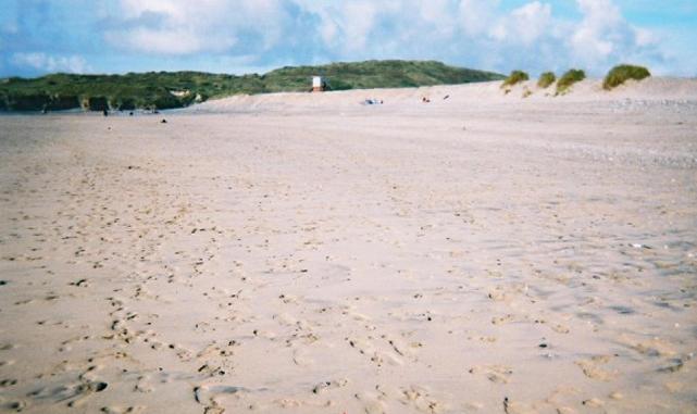
The catchment surrounding Gwithian Towans is approximately 6,200 hectares. The Red
River enters St Ives Bay approximately 280m north of the Environment Agency monitoring
point at Gwithian, and the Hayle Estuary system is approximately three kilometres
(km) to the south. The Red River is approximately 13km (35km long including major
tributaries) and rises from springs near Bolenowe. The steep catchment means rain
runs off rapidly into the river.
In the past the Red River has been affected by the mining industry at Tuckingmill,
Pool, Redruth, and Camborne. Land use in the rural areas is mostly arable near the
coast and improved grassland with some dairy farming on the higher ground. Much of
the coast in this part of Cornwall has been designated as a Site of Special Scientific
Interest (SSSI).
Seaweed (macroalgae) and phytoplankton (microscopic algae) are a natural part of the
marine and freshwater environment. Below we note whether these have been recorded
in quantities sufficient to be a nuisance.
The majority of sewers in England are “combined sewers” and carry both sewage and
surface water from roofs and drains. A storm overflow operates during heavy rainfall
when the sewerage system becomes overwhelmed by the amount of surface water. The overflow
prevents sewage from backing up pipes and flooding properties and gardens. An emergency
overflow will only operate infrequently, for example due to pump failure or blockage
in the sewerage system.
Heavy rain falling on pavements and roads often flows into surface water drains or
highway drains, ending up in local rivers and ultimately the sea. The quality of bathing
water may be adversely affected as a result of such events.
It is the Environment Agency role to drive improvement of water quality at bathing
waters that are at risk of failing higher standards. It is natural for water to run
off the land to the sea. Water quality at a bathing water is dependent upon the type
and area of land (the catchment) draining to the water and the activities undertaken
in that catchment.


