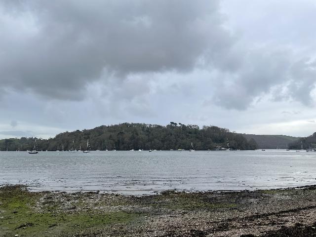
The Ham is a tidal beach on within Dart Estuary at Dittisham, Devon. It is a small
section of estuary approximately 200 metres wide, backed by a park. It can be accessed
from the shingle ridge. Due to flow in the estuary swimming is only accessible at
high to mid tide.
There are a number of permitted storm overflows that discharge into the River Dart
and Estuary. In the 1km section of the designated bathing water, there are a Storm
overflow at Dittsham STW and a Sewage Pumping Station (Ferry Boat Inn PS).
When these outfalls are operating, they discharge diluted effluent into the river
which may result in reduced bathing water quality.
South West Water has made significant sewage improvements in the Dart Estuary over
several rounds of investment.
Several Sewage Treatment Works in the estuary have undergone improvement schemes to
provide secondary treatment and ultraviolet (UV) disinfection.
Many storm overflows across the Dart Estuary have been upgraded to enhance environmental
protection.
Storm overflow event duration monitoring (EDM) has been installed at all storm overflows
across the South West Water Network, and all data is publicly available.
Since 2023, South West Water has been conducting a project to investigate water quality
in this catchment through the Dart and Tavy Bathing Water Pilot. This project includes
additional monitoring beyond statutory requirements and accelerated investment in
assets and infrastructure.
The Environment Agency works with the water companies, local authorities and others
to investigate any sources of contamination and to improve water quality at local
bathing waters. The Environment Agency continues to work with and support local environmental
groups with citizen science sampling projects on the Dart and its tributaries.
Heavy rain falling on pavements and roads often flows into surface water drains or
highway drains, ending up in local rivers and ultimately the sea. The quality of bathing
water may be adversely affected as a result of such events.
This bathing water has some history of large amounts of seaweed (macro algae) and
can become covered with large amounts of seaweed at certain times of the year, depending
on tides and the weather. Groynes and rocks, platforms or other fixed objects may
also develop a covering of seaweed which can be slippery.
Modern sewerage systems have two separate systems, one takes foul sewage to sewage
treatment, the other takes rainwater runoff through surface water drains to rivers,
lakes and the sea. Misconnections occur when waste water pipes are plumbed into surface
water drains instead of the foul water sewerage system. This can give rise to pollution
when the waste water is discharged directly to the environment through the surface
water drain. For example, a washing machine or toilet may be incorrectly plumbed so
that it discharges to the surface drain rather than the foul sewage drain.
Wrongly connected domestic waste water pipes can also affect the bathing water quality.
We have checked the local sewerage system for misconnections. We are working with
South Hams District Council and South West Water to identify and rectify any problems
when they arise.
Phytoplankton (microscopic algae) naturally increase in number at certain times of
the year. This process is known as a phytoplankton bloom. These blooms can discolour
the water or form as a foam on the water. This bathing water does not have a history
of phytoplankton blooms.
The risks to human health from contact, ingestion or inhalation with marine algae
that currently occur in UK coastal waters are considered to be low. However, some
individuals may be more sensitive and display some reactions.
A common marine algae found in UK coastal waters is Phaeocystis, which is often mistaken
for sewage as it forms foam and a brown scum, but it is non-toxic.
There are no active pollution risk forecasts made at this bathing water. However any
bathing water has the potential to be affected by a pollution incident and if this
occurs a pollution risk warning with associated advice against bathing will be issued
on this website.
This bathing water is on the Dart Estuary which can be affected after heavy rainfall.
There are 2 small streams entering the bathing water and the Ham pond also overtops
onto the beach.
Environment Agency samplers make observations of litter present on the beach at every
visit, this includes assessments of sewage debris, litter and tar.
Part of the Environment Agency's role is to work with farmers to reduce the effects
of farming on water quality. The Environment Agency provide advice to farmers on how
to comply with regulations and good practice on farms to ensure that pollution entering
watercourses is minimised.
This bathing water is within the South Devon National Landscape. The National Landscape,
through Farming in Protected Landscapes and the South Devon Connectivity Farm Facilitation
Group, has been providing advice and funding to landowners within the catchment to
benefit water quality.
This bathing water designation was submitted by the Friends of the Dart group. The
group is a catchment focused action group working to minimise pollution, improve biodiversity
and empower communities from source to sea.
The Environment Agency will be working with the group and others in the catchment
to ensure source of pollution are managed and rectified where possible.
There are a number of private sewage treatment plants and septic tanks within the
catchment and the Environment Agency continues to work with the owners to ensure that
these are adequately maintained and do not impact on the water quality of the streams
they discharge to.
The Dart Estuary catchment area covers approximately 48,000 hectares. The river Dart
originates in north Dartmoor and stretches about 28 kilometers in length. It passes
through Dartmeet, Buckfastleigh, Totnes, and Dartmouth, and finally reaches the estuary
mouth at Kingswear. The Dart Estuary is affected by tides up to the weir at Totnes,
and like other estuaries in the South West, it was formed by the flooding of the original
deep river valley due to rising sea levels. This resulted in the characteristic deep
waters and steep-sided banks of a ria. The main tributaries that flow into the estuary
are the rivers Hems and Harbourne. The catchment area is mainly used for agriculture
and tourism.
Seaweed (macroalgae) and phytoplankton (microscopic algae) are a natural part of the
marine and freshwater environment. Below we note whether these have been recorded
in quantities sufficient to be a nuisance.
The majority of sewers in England are “combined sewers” and carry both sewage and
surface water from roofs and drains. A storm overflow operates during heavy rainfall
when the sewerage system becomes overwhelmed by the amount of surface water. The overflow
prevents sewage from backing up pipes and flooding properties and gardens. An emergency
overflow will only operate infrequently, for example due to pump failure or blockage
in the sewerage system.
Heavy rain falling on pavements and roads often flows into surface water drains or
highway drains, ending up in local rivers and ultimately the sea. The quality of bathing
water may be adversely affected as a result of such events.
It is the Environment Agency role to drive improvement of water quality at bathing
waters that are at risk of failing higher standards. It is natural for water to run
off the land to the sea. Water quality at a bathing water is dependent upon the type
and area of land (the catchment) draining to the water and the activities undertaken
in that catchment.


