Flaghead Chine to Handfast Point, including Poole Harbour 3
General actions for this subsection
There are no actions generic to the whole of this subsection. For actions relating to specific locations, select an area on the map above or use the postcode/location search and click on the Action Plan tab.
All actions are subject to funding and approval, often by other parties than the Lead Organisation shown.
Download SMP documents
The information on this website represents the current SMP management approaches adopted by the local authorities within its area, and current actions needed to deliver them. These management approaches have been approved by the Environment Agency under its Strategic Overview for coastal flood and erosion risk management and are considered to be local policy.
The documents below provide the full SMP adopted locally and approved by the Environment Agency at the time of publication. Some of the information has changed in response to new government policy, new evidence or new work identified.
Data on this page
Main report
Appendices
- Appendix A - SMP Development
- Appendix B - Stakeholder Engagement
Appendix C - Baseline Process Understanding:
- Appendix D - Natural and Built Environment Baseline (Thematic Review)
- Appendix E - Issues and Objectives
- Appendix F - Strategic Environmental Assessment
- Appendix G - Scenario Testing
- Appendix H - Economics
- Appendix I - Estuary Assessment1
- Appendix J - Habitat Regulation Assessment
- Appendix K - Metadatabase
- Appendix L - Water Framework Directive
- Appendix M - Review of Hengistbury Head
- Appendix N - Client Steering Group Approvals
About this subsection
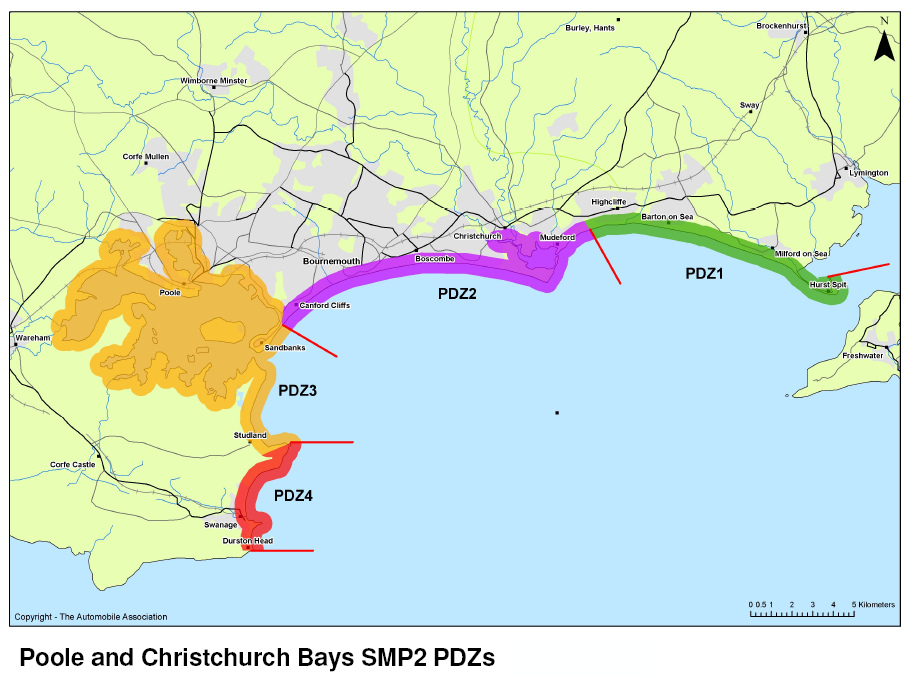
This subsection of the SMP includes the long sweep of open coast from Sandbanks across the mouth of Poole Harbour and along the beaches of Shell Bay and Studland Bay.
The open coast area forms the coastal barrier system to Poole Harbour. Sandbanks spit contains Sandbanks village and the access road to Poole. Defending this area also holds the spit in position and helps regulate the behaviour of Poole Harbour. The Studland Bay area forms the easternmost part of the Jurassic Coast UNESCO World Heritage Site, the eastern edge of the Dorset Area of Outstanding Natural Beauty and the Purbeck Heaths National Nature Reserve. The inshore area of Studland Bay is a Marine Conservation Zone. Towards Old Harry Rocks at Handfast Point, the low-lying coastal land rises to chalk cliffs.
The northern shore of Poole Harbour includes the core residential, commercial and heritage centre of Poole, including marinas and cross-channel ferry terminal. Parkstone Bay and around the shoreline of Whitley Lake are popular recreational areas. These areas also have an accumulation of sediment which maintain the inter-tidal habitats there. The SMP includes the areas of Holes Bay and Lytchett Bay, two tidal inland water bodies which lie either side of the Hamworthy area of Poole. The Rivers Piddle and Frome empty into the Wareham Channel in the western part of Poole Harbour, with rail links and industrial sites along the northern shore outside the tidal flood zone. The SMP Management Units trace the shoreline along the flood banks in place at the time of the SMP’s development, which protect nearby buildings at Wareham and freshwater habitats such as Arne Reedbeds National Nature Reserve.
The southern and western parts of Poole Harbour include the Arne Peninsula, Brownsea Island and various smaller island such as Furzey Island. Apart from isolated properties and small-scale tourist facilities, this area is mostly uninhabited and undeveloped but there are important well head installations associated with the Wytch Farm oil field, as well as sites of historic importance such as Brownsea Castle.
The whole of Poole Harbour’s inshore, inter-tidal and freshwater habitat is legally protected for its internationally important wildlife.